Okinawa geodata
Okinawa is a seat of a second-order administrative division; located in Japan in Asia/Tokyo (GMT+9) time zone. With population of 125,483 people, there are 168 cities with bigger population in this country. Compared to other cities in Japan, 98.9% of cities are located further ↑North; 99% of cities are located further →East and 78.9% of cities have lower elevation than Okinawa. Note1


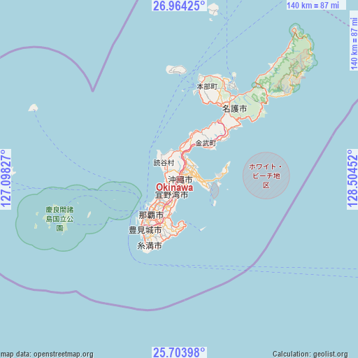
Okinawa GPS coordinates[2]
26° 20' 8.988" North, 127° 48' 5.004" East
| Map corner | latitude | longitude |
|---|---|---|
| Upper-left | 26.96425°, | 127.09827° |
| Center: | 26.33583°, | 127.80139° |
| Lower-right: | 25.70398°, | 128.50452° |
| Map W x H: | 140.1×140.1 km | = 87.1×87.1mi |
| max Lat: | 45.40944° ⇑98.9% North |
| Okinawa: | 26.33583° |
| min Lat: | ⇓1.1% South 24.34478° |
| min Long | Okinawa | max Long |
| 123° | 127.80139° | 145.575° |
| W 1%⇐ | ⇒99% E |
Elevation
Elevation of Okinawa is 112 m = 367 ft, and this is 27.4 m = 90 ft above average elevation for this country.
| Max E: |
1086 m = 3563 ft | 21.1% |
| Okinawa | 112 m 367 ft | |
| Avg. | 84.6 m = 278 ft | |
Min E: |
-2 m = -7 ft | 78.9% |
See also: Okinawa elevation on elevation.city.
Geographical zone
Okinawa is located in North temperate zone (between Tropic of Cancer and the Arctic Circle). Distance of this Northern Tropic circle is 322.4 km =200.3 mi to South.| Distance of | km | miles | from Okinawa |
|---|---|---|---|
| North Pole | 7078.8 | 4398.6 | to North |
| Arctic Circle | 4472.9 | 2779.3 | to North |
| Tropic Cancer | 322.4 | 200.3 | to South |
| Equator | 2928.3 | 1819.6 | to South |


Nearby cities:
15 places around Okinawa: (largest is in red/bold)
• Amami
281.8 km =175.1 mi,  36°
36°
• Chatan
4.3 km =2.7 mi,  226°
226°
• Ginowan
9.1 km =5.7 mi,  206°
206°
• Gushikawa
7.1 km =4.4 mi,  68°
68°
• Hirara
303.1 km =188.3 mi,  235°
235°
• Ishikawa
9.9 km =6.2 mi,  11°
11°
• Itoman
26.8 km =16.7 mi, 209°
• Katsuren-haebaru
7.2 km =4.5 mi,  92°
92°
• Nago
36 km =22.4 mi,  30°
30°
• Naha
17.7 km =11 mi,  221°
221°
• Nanjō
21.6 km =13.4 mi,  189°
189°
• Naze
280.3 km =174.2 mi, 36°
• Tomigusuku
20.5 km =12.7 mi, 215°
• Urasoe
11.1 km =6.9 mi, 219°
• Uruma
7.3 km =4.5 mi,  52°
52°
Sources, notices
• [Note1] Compared only with cities in Japan existing in our database
• [Src1] Map data: © OpenStreetMap contributors (CC-BY-SA)
• [Src2] Other city data from geonames.org with taken over terms of usage.
• [Src3] Geographical zone / Annual Mean Temperature by Robert A. Rohde @ Wikipedia
