Ginowan geodata
Ginowan (Okinawa) is a seat of a second-order administrative division; located in Japan in Asia/Tokyo (GMT+9) time zone. With population of 91,800 people, there are 220 cities with bigger population in this country. Compared to other cities in Japan, 99.2% of cities are located further ↑North; 99.3% of cities are located further →East and 77% of cities have lower elevation than Ginowan. Note1


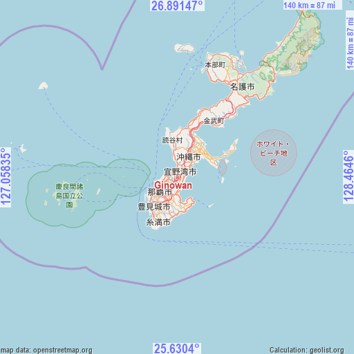
Ginowan GPS coordinates[2]
26° 15' 45.54" North, 127° 45' 41.292" East
| Map corner | latitude | longitude |
|---|---|---|
| Upper-left | 26.89147°, | 127.05835° |
| Center: | 26.26265°, | 127.76147° |
| Lower-right: | 25.6304°, | 128.4646° |
| Map W x H: | 140.2×140.2 km | = 87.1×87.1mi |
| max Lat: | 45.40944° ⇑99.2% North |
| Ginowan: | 26.26265° |
| min Lat: | ⇓0.8% South 24.34478° |
| min Long | Ginowan | max Long |
| 123° | 127.76147° | 145.575° |
| W 0.7%⇐ | ⇒99.3% E |
Elevation
Elevation of Ginowan is 105 m = 344 ft, and this is 20.4 m = 67 ft above average elevation for this country.
| Max E: |
1086 m = 3563 ft | 23% |
| Ginowan | 105 m 344 ft | |
| Avg. | 84.6 m = 278 ft | |
Min E: |
-2 m = -7 ft | 77% |
See also: Ginowan elevation on elevation.city.
Geographical zone
Ginowan is located in North temperate zone (between Tropic of Cancer and the Arctic Circle). Distance of this Northern Tropic circle is 314.2 km =195.2 mi to South.| Distance of | km | miles | from Ginowan |
|---|---|---|---|
| North Pole | 7086.9 | 4403.6 | to North |
| Arctic Circle | 4481 | 2784.4 | to North |
| Tropic Cancer | 314.2 | 195.2 | to South |
| Equator | 2920.1 | 1814.5 | to South |


Nearby cities:
15 places around Ginowan: (largest is in red/bold)
• Amami
290.8 km =180.7 mi,  36°
36°
• Chatan
5.3 km =3.3 mi,  9°
9°
• Gushikawa
15.1 km =9.4 mi, 44°
• Hirara
295.3 km =183.5 mi,  236°
236°
• Ishikawa
18.8 km =11.7 mi,  18°
18°
• Itoman
17.7 km =11 mi,  211°
211°
• Katsuren-haebaru
13.7 km =8.5 mi,  55°
55°
• Nago
45.1 km =28 mi,  29°
29°
• Naha
9.3 km =5.8 mi, 236°
• Nanjō
13.2 km =8.2 mi,  177°
177°
• Naze
289.2 km =179.7 mi, 36°
• Okinawa
9.1 km =5.7 mi, 26°
• Tomigusuku
11.7 km =7.3 mi,  222°
222°
• Urasoe
3.2 km =2 mi,  262°
262°
• Uruma
15.9 km =9.9 mi, 37°
Sources, notices
• [Note1] Compared only with cities in Japan existing in our database
• [Src1] Map data: © OpenStreetMap contributors (CC-BY-SA)
• [Src2] Other city data from geonames.org with taken over terms of usage.
• [Src3] Geographical zone / Annual Mean Temperature by Robert A. Rohde @ Wikipedia
