Ninohe geodata
Ninohe (Iwate) is a seat of a second-order administrative division; located in Japan in Asia/Tokyo (GMT+9) time zone. In our database, there are 767 cities with bigger population. Compared to other cities in Japan, 93.9% of cities are located further ↓South; 95% of cities are located further ←West and 91.7% of cities have lower elevation than Ninohe. Note1


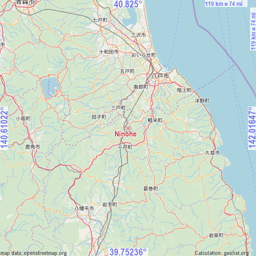
Ninohe GPS coordinates[2]
40° 17' 26.916" North, 141° 18' 48.024" East
| Map corner | latitude | longitude |
|---|---|---|
| Upper-left | 40.825°, | 140.61022° |
| Center: | 40.29081°, | 141.31334° |
| Lower-right: | 39.75236°, | 142.01647° |
| Map W x H: | 119.3×119.3 km | = 74.1×74.1mi |
| max Lat: | 45.40944° ⇑6.1% North |
| Ninohe: | 40.29081° |
| min Lat: | ⇓93.9% South 24.34478° |
| min Long | Ninohe | max Long |
| 123° | 141.31334° | 145.575° |
| W 95%⇐ | ⇒5% E |
Elevation
Elevation of Ninohe is 261 m = 856 ft, and this is 176.4 m = 579 ft above average elevation for this country.
| Max E: |
1086 m = 3563 ft | 8.3% |
| Ninohe | 261 m 856 ft | |
| Avg. | 84.6 m = 278 ft | |
Min E: |
-2 m = -7 ft | 91.7% |
See also: Japan elevation on elevation.city.
Geographical zone
Ninohe is located in North temperate zone (between Tropic of Cancer and the Arctic Circle). Distance of this Northern Tropic circle is 1874 km =1164.4 mi to South.| Distance of | km | miles | from Ninohe |
|---|---|---|---|
| North Pole | 5527.1 | 3434.4 | to North |
| Arctic Circle | 2921.3 | 1815.2 | to North |
| Tropic Cancer | 1874 | 1164.4 | to South |
| Equator | 4479.9 | 2783.7 | to South |


Nearby cities:
15 places around Ninohe: (largest is in red/bold)
• Furudate
26.5 km =16.5 mi,  358°
358°
• Hachimantai
46.2 km =28.7 mi,  199°
199°
• Hachinohe
28.1 km =17.5 mi,  34°
34°
• Hanawa
46.2 km =28.7 mi,  255°
255°
• Hirakawa
70.9 km =44.1 mi,  297°
297°
• Ichinohe
8.2 km =5.1 mi,  194°
194°
• Inuotose
34.6 km =21.5 mi,  1°
1°
• Kazuno
45.9 km =28.5 mi, 258°
• Kuji
40.3 km =25 mi,  106°
106°
• Kuroishi
63 km =39.1 mi, 304°
• Misawa
44.5 km =27.7 mi,  8°
8°
• Morioka
67.1 km =41.7 mi, 191°
• Takizawa
56.4 km =35 mi, 195°
• Towada
37.7 km =23.4 mi,  346°
346°
• Ōdate
64.1 km =39.8 mi,  268°
268°
Sources, notices
• [Note1] Compared only with cities in Japan existing in our database
• [Src1] Map data: © OpenStreetMap contributors (CC-BY-SA)
• [Src2] Other city data from geonames.org with taken over terms of usage.
• [Src3] Geographical zone / Annual Mean Temperature by Robert A. Rohde @ Wikipedia
