Hokuto geodata
Hokuto (Hokkaido) is a seat of a second-order administrative division; located in Japan in Asia/Tokyo (GMT+9) time zone. In our database, there are 767 cities with bigger population. Compared to other cities in Japan, 95.5% of cities are located further ↓South; 89.4% of cities are located further ←West and 71.1% of cities have higher elevation than Hokuto. Note1


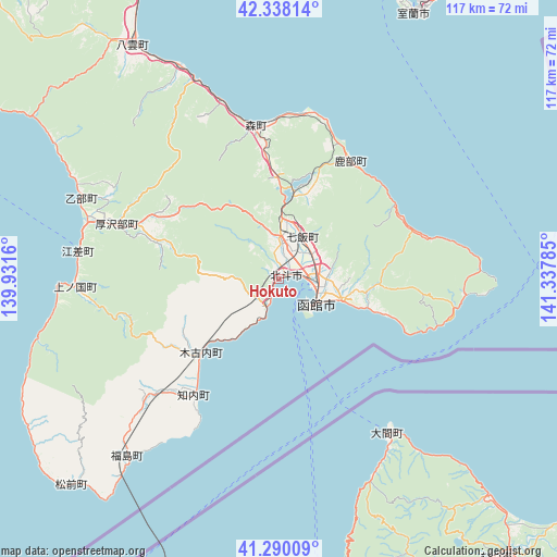
Hokuto GPS coordinates[2]
41° 48' 58.536" North, 140° 38' 4.992" East
| Map corner | latitude | longitude |
|---|---|---|
| Upper-left | 42.33814°, | 139.9316° |
| Center: | 41.81626°, | 140.63472° |
| Lower-right: | 41.29009°, | 141.33785° |
| Map W x H: | 116.5×116.5 km | = 72.4×72.4mi |
| max Lat: | 45.40944° ⇑4.5% North |
| Hokuto: | 41.81626° |
| min Lat: | ⇓95.5% South 24.34478° |
| min Long | Hokuto | max Long |
| 123° | 140.63472° | 145.575° |
| W 89.4%⇐ | ⇒10.6% E |
Elevation
Elevation of Hokuto is 11 m = 36 ft, and this is 73.6 m = 241 ft below average elevation for this country.
| Max E: |
1086 m = 3563 ft | 71.1% |
| Avg. | 84.6 m = 278 ft | |
| Hokuto | 11 m = 36 ft | |
Min E: |
-2 m = -7 ft | 28.9% |
See also: Japan elevation on elevation.city.
Geographical zone
Hokuto is located in North temperate zone (between Tropic of Cancer and the Arctic Circle). Distance of this Northern Tropic circle is 2043.6 km =1269.8 mi to South.| Distance of | km | miles | from Hokuto |
|---|---|---|---|
| North Pole | 5357.5 | 3329 | to North |
| Arctic Circle | 2751.6 | 1709.8 | to North |
| Tropic Cancer | 2043.6 | 1269.8 | to South |
| Equator | 4649.5 | 2889.1 | to South |


Nearby cities:
15 places around Hokuto: (largest is in red/bold)
• Aomori
111.4 km =69.2 mi,  175°
175°
• Date
75 km =46.6 mi,  14°
14°
• Goshogawara
113.7 km =70.6 mi,  188°
188°
• Hakodate
9.6 km =6 mi,  118°
118°
• Honchō
10 km =6.2 mi,  29°
29°
• Kamiiso
0.9 km =0.6 mi,  62°
62°
• Muroran
62.9 km =39.1 mi, 27°
• Mutsu
76 km =47.2 mi,  140°
140°
• Namioka
123 km =76.4 mi, 181°
• Niseko Town
107.1 km =66.5 mi,  1°
1°
• Noboribetsu
83.8 km =52.1 mi, 32°
• Shimokizukuri
113.3 km =70.4 mi, 191°
• Shiraoi
100.6 km =62.5 mi,  35°
35°
• Tomakomai
121.2 km =75.3 mi, 41°
• Tsugaru
114.3 km =71 mi, 189°
Sources, notices
• [Note1] Compared only with cities in Japan existing in our database
• [Src1] Map data: © OpenStreetMap contributors (CC-BY-SA)
• [Src2] Other city data from geonames.org with taken over terms of usage.
• [Src3] Geographical zone / Annual Mean Temperature by Robert A. Rohde @ Wikipedia
