Rishiri Town geodata
Rishiri Town (Hokkaido) is a populated place; located in Japan in Asia/Tokyo (GMT+9) time zone. With population of 2,684 people, there are 757 cities with bigger population in this country. Compared to other cities in Japan, 99.8% of cities are located further ↓South; 94.4% of cities are located further ←West and 94.8% of cities have lower elevation than Rishiri Town. Note1


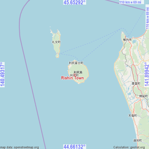
Rishiri Town GPS coordinates[2]
45° 9' 33.408" North, 141° 11' 46.644" East
| Map corner | latitude | longitude |
|---|---|---|
| Upper-left | 45.65292°, | 140.49317° |
| Center: | 45.15928°, | 141.19629° |
| Lower-right: | 44.66132°, | 141.89942° |
| Map W x H: | 110.3×110.3 km | = 68.5×68.5mi |
| max Lat: | 45.40944° ⇑0.2% North |
| Rishiri Town: | 45.15928° |
| min Lat: | ⇓99.8% South 24.34478° |
| min Long | Rishiri Town | max Long |
| 123° | 141.19629° | 145.575° |
| W 94.4%⇐ | ⇒5.6% E |
Elevation
Elevation of Rishiri Town is 355 m = 1165 ft, and this is 270.4 m = 887 ft above average elevation for this country.
| Max E: |
1086 m = 3563 ft | 5.2% |
| Rishiri Town | 355 m 1165 ft | |
| Avg. | 84.6 m = 278 ft | |
Min E: |
-2 m = -7 ft | 94.8% |
See also: Japan elevation on elevation.city.
Geographical zone
Rishiri Town is located in North temperate zone (between Tropic of Cancer and the Arctic Circle). Distance of this North polar circle is 2379.9 km =1478.8 mi to North.| Distance of | km | miles | from Rishiri Town |
|---|---|---|---|
| North Pole | 4985.8 | 3098 | to North |
| Arctic Circle | 2379.9 | 1478.8 | to North |
| Tropic Cancer | 2415.3 | 1500.8 | to South |
| Equator | 5021.2 | 3120 | to South |


Nearby cities:
15 places around Rishiri Town: (largest is in red/bold)
• Akabira
191.3 km =118.9 mi,  159°
159°
• Asahikawa
180.1 km =111.9 mi,  149°
149°
• Ashibetsu
199.6 km =124 mi, 156°
• Fukagawa
174.7 km =108.6 mi, 157°
• Kamikawa
192.6 km =119.7 mi,  139°
139°
• Makubetsu
54.3 km =33.7 mi,  64°
64°
• Mobetsu
197.4 km =122.7 mi,  120°
120°
• Mombetsu
192.4 km =119.6 mi, 117°
• Nayoro
134.2 km =83.4 mi,  132°
132°
• Rumoi
140.7 km =87.4 mi,  165°
165°
• Shibetsu
145.1 km =90.2 mi, 139°
• Sunagawa
194.4 km =120.8 mi, 163°
• Takikawa
187.3 km =116.4 mi, 162°
• Utashinai
194.8 km =121 mi, 159°
• Wakkanai
46.6 km =29 mi,  53°
53°
Sources, notices
• [Note1] Compared only with cities in Japan existing in our database
• [Src1] Map data: © OpenStreetMap contributors (CC-BY-SA)
• [Src2] Other city data from geonames.org with taken over terms of usage.
• [Src3] Geographical zone / Annual Mean Temperature by Robert A. Rohde @ Wikipedia
