Ayabe geodata
Ayabe (Kyoto) is a seat of a second-order administrative division; located in Japan in Asia/Tokyo (GMT+9) time zone. With population of 37,612 people, there are 476 cities with bigger population in this country. Compared to other cities in Japan, 52.2% of cities are located further ↑North; 69.2% of cities are located further →East and 60.4% of cities have lower elevation than Ayabe. Note1


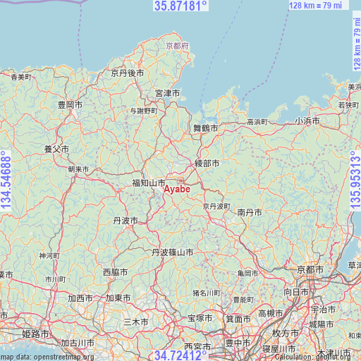
Ayabe GPS coordinates[2]
35° 18' 0" North, 135° 15' 0" East
| Map corner | latitude | longitude |
|---|---|---|
| Upper-left | 35.87181°, | 134.54688° |
| Center: | 35.3°, | 135.25° |
| Lower-right: | 34.72412°, | 135.95313° |
| Map W x H: | 127.6×127.6 km | = 79.3×79.3mi |
| max Lat: | 45.40944° ⇑52.2% North |
| Ayabe: | 35.3° |
| min Lat: | ⇓47.8% South 24.34478° |
| min Long | Ayabe | max Long |
| 123° | 135.25° | 145.575° |
| W 30.8%⇐ | ⇒69.2% E |
Elevation
Elevation of Ayabe is 46 m = 151 ft, and this is 38.6 m = 127 ft below average elevation for this country.
| Max E: |
1086 m = 3563 ft | 39.6% |
| Avg. | 84.6 m = 278 ft | |
| Ayabe | 46 m = 151 ft | |
Min E: |
-2 m = -7 ft | 60.4% |
See also: Japan elevation on elevation.city.
Geographical zone
Ayabe is located in North temperate zone (between Tropic of Cancer and the Arctic Circle). Distance of this Northern Tropic circle is 1319.1 km =819.7 mi to South.| Distance of | km | miles | from Ayabe |
|---|---|---|---|
| North Pole | 6082.1 | 3779.2 | to North |
| Arctic Circle | 3476.2 | 2160 | to North |
| Tropic Cancer | 1319.1 | 819.7 | to South |
| Equator | 3925 | 2438.9 | to South |


Nearby cities:
15 places around Ayabe: (largest is in red/bold)
• Asago
39.8 km =24.7 mi,  263°
263°
• Fukuchiyama
12.1 km =7.5 mi,  270°
270°
• Kameoka
45.1 km =28 mi,  137°
137°
• Katō
46.5 km =28.9 mi,  205°
205°
• Kyōtango
38.8 km =24.1 mi,  331°
331°
• Maizuru
18.3 km =11.4 mi,  24°
24°
• Miyazu
26.6 km =16.5 mi,  346°
346°
• Nantan
30.5 km =19 mi,  133°
133°
• Nishiwaki
43.2 km =26.8 mi,  215°
215°
• Sanda
39.4 km =24.5 mi,  184°
184°
• Sandachō
46.3 km =28.8 mi, 182°
• Sasayama
26.1 km =16.2 mi,  186°
186°
• Tanba
24.7 km =15.3 mi,  230°
230°
• Toyooka
47.2 km =29.3 mi,  304°
304°
• Yabu
44.9 km =27.9 mi,  284°
284°
Sources, notices
• [Note1] Compared only with cities in Japan existing in our database
• [Src1] Map data: © OpenStreetMap contributors (CC-BY-SA)
• [Src2] Other city data from geonames.org with taken over terms of usage.
• [Src3] Geographical zone / Annual Mean Temperature by Robert A. Rohde @ Wikipedia
