Makueni Boma geodata
Makueni Boma (Makueni) is a populated place; located in Kenya in Africa/Nairobi (GMT+3) time zone. With population of 20,681 people, there are 45 cities with bigger population in this country. Compared to other cities in Kenya, 82.5% of cities are located further ↑North; 72.8% of cities are located further ←West and 65.8% of cities have higher elevation than Makueni Boma. Note1


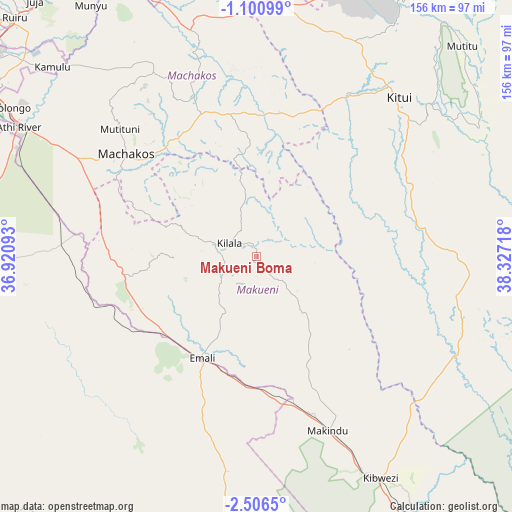
Makueni Boma GPS coordinates[2]
1° 48' 13.968" South, 37° 37' 26.58" East
| Map corner | latitude | longitude |
|---|---|---|
| Upper-left | -1.10099°, | 36.92093° |
| Center: | -1.80388°, | 37.62405° |
| Lower-right: | -2.5065°, | 38.32718° |
| Map W x H: | 156.3×156.3 km | = 97.1×97.1mi |
| max Lat: | 3.93726° ⇑82.5% North |
| Makueni Boma: | -1.80388° |
| min Lat: | ⇓17.5% South -4.64756° |
| min Long | Makueni Boma | max Long |
| 33.97248° | 37.62405° | 41.85688° |
| W 72.8%⇐ | ⇒27.2% E |
Elevation
Elevation of Makueni Boma is 1219 m = 3999 ft, and this is 127.7 m = 419 ft below average elevation for this country.
| Max E: |
2514 m = 8248 ft | 65.8% |
| Avg. | 1346.7 m = 4418 ft | |
| Makueni Boma | 1219 m = 3999 ft | |
Min E: |
7 m = 23 ft | 34.2% |
See also: Kenya elevation on elevation.city.
Geographical zone
Makueni Boma is located in South Torrid zone (between Equator and Tropic of Capricorn). Distance of Equator is 200.6 km =124.6 mi to North.| Distance of | km | miles | from Makueni Boma |
|---|---|---|---|
| Equator | 200.6 | 124.6 | to North |
| Tropic Capricorn | 2405.3 | 1494.6 | to South |
| Antarctic Circle | 7200.6 | 4474.2 | to South |
| South Pole | 9806.5 | 6093.5 | to South |


Nearby cities:
15 places around Makueni Boma: (largest is in red/bold)
• Athi River
81.5 km =50.6 mi,  298°
298°
• Kajiado
94.3 km =58.6 mi,  266°
266°
• Kandara
122.2 km =75.9 mi,  325°
325°
• Kangundo
63.5 km =39.5 mi, 331°
• Kiambu
112.4 km =69.8 mi,  308°
308°
• Kitui
64.8 km =40.3 mi,  41°
41°
• Konza
55.2 km =34.3 mi,  277°
277°
• Machakos
50.7 km =31.5 mi, 308°
• Mtito Andei
115.5 km =71.8 mi,  148°
148°
• Mwingi
108 km =67.1 mi,  26°
26°
• Nairobi
106.8 km =66.4 mi, 302°
• Ngong
117.3 km =72.9 mi, 295°
• Pumwani
103.7 km =64.4 mi, 303°
• Thika
105.6 km =65.6 mi,  324°
324°
• Wote
2.6 km =1.6 mi,  11°
11°
Sources, notices
• [Note1] Compared only with cities in Kenya existing in our database
• [Src1] Map data: © OpenStreetMap contributors (CC-BY-SA)
• [Src2] Other city data from geonames.org with taken over terms of usage.
• [Src3] Geographical zone / Annual Mean Temperature by Robert A. Rohde @ Wikipedia
