Lugulu geodata
Lugulu (Busia) is a populated place; located in Kenya in Africa/Nairobi (GMT+3) time zone. With population of 40,894 people, there are 21 cities with bigger population in this country. Compared to other cities in Kenya, 81.6% of cities are located further ↓South; 93% of cities are located further →East and 64.9% of cities have higher elevation than Lugulu. Note1


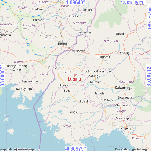
Lugulu GPS coordinates[2]
0° 23' 36.132" North, 34° 18' 14.364" East
| Map corner | latitude | longitude |
|---|---|---|
| Upper-left | 1.09643°, | 33.60087° |
| Center: | 0.39337°, | 34.30399° |
| Lower-right: | -0.30975°, | 35.00712° |
| Map W x H: | 156.4×156.4 km | = 97.2×97.2mi |
| max Lat: | 3.93726° ⇑18.4% North |
| Lugulu: | 0.39337° |
| min Lat: | ⇓81.6% South -4.64756° |
| min Long | Lugulu | max Long |
| 33.97248° | 34.30399° | 41.85688° |
| W 7%⇐ | ⇒93% E |
Elevation
Elevation of Lugulu is 1220 m = 4003 ft, and this is 126.7 m = 416 ft below average elevation for this country.
| Max E: |
2514 m = 8248 ft | 64.9% |
| Avg. | 1346.7 m = 4418 ft | |
| Lugulu | 1220 m = 4003 ft | |
Min E: |
7 m = 23 ft | 35.1% |
See also: Lugulu elevation on elevation.city.
Geographical zone
Lugulu is located in North Torrid zone (between Equator and Tropic of Cancer). Distance of Equator is 43.7 km =27.2 mi to South.| Distance of | km | miles | from Lugulu |
|---|---|---|---|
| North Pole | 9963.3 | 6190.9 | to North |
| Arctic Circle | 7357.4 | 4571.7 | to North |
| Tropic Cancer | 2562.2 | 1592.1 | to North |
| Equator | 43.7 | 27.2 | to South |


Nearby cities:
15 places around Lugulu: (largest is in red/bold)
• Bondo
17.8 km =11.1 mi,  188°
188°
• Bungoma
34.2 km =21.3 mi,  56°
56°
• Bungoma
37.6 km =23.4 mi, 55°
• Busia
22.6 km =14 mi,  289°
289°
• Butere
29.3 km =18.2 mi,  135°
135°
• Kakamega
51.3 km =31.9 mi,  103°
103°
• Luanda
27.3 km =17 mi,  251°
251°
• Malaba
27 km =16.8 mi,  354°
354°
• Malikisi
34.1 km =21.2 mi,  22°
22°
• Mumias
21.5 km =13.4 mi,  107°
107°
• Nambare
9.1 km =5.7 mi,  322°
322°
• Port Victoria
49.4 km =30.7 mi,  228°
228°
• Siaya
37 km =23 mi,  182°
182°
• Sirisia
45.7 km =28.4 mi, 227°
• Yala
42.1 km =26.2 mi, 142°
Sources, notices
• [Note1] Compared only with cities in Kenya existing in our database
• [Src1] Map data: © OpenStreetMap contributors (CC-BY-SA)
• [Src2] Other city data from geonames.org with taken over terms of usage.
• [Src3] Geographical zone / Annual Mean Temperature by Robert A. Rohde @ Wikipedia
