Kihancha geodata
Kihancha (Migori) is a populated place; located in Kenya in Africa/Nairobi (GMT+3) time zone. With population of 13,162 people, there are 54 cities with bigger population in this country. Compared to other cities in Kenya, 71.9% of cities are located further ↑North; 85.1% of cities are located further →East and 52.6% of cities have lower elevation than Kihancha. Note1


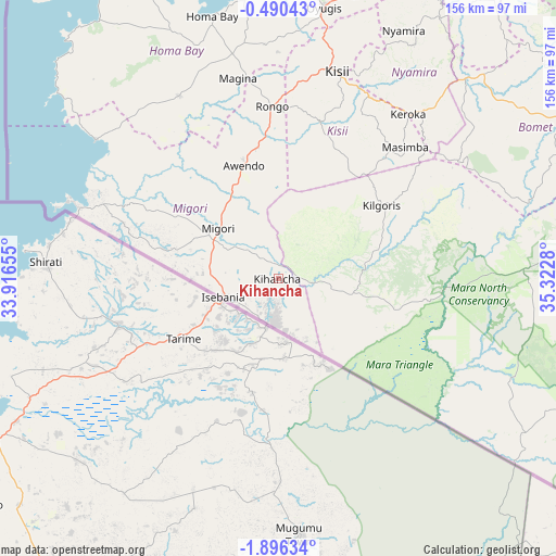
Kihancha GPS coordinates[2]
1° 11' 36.492" South, 34° 37' 10.812" East
| Map corner | latitude | longitude |
|---|---|---|
| Upper-left | -0.49043°, | 33.91655° |
| Center: | -1.19347°, | 34.61967° |
| Lower-right: | -1.89634°, | 35.3228° |
| Map W x H: | 156.3×156.3 km | = 97.1×97.1mi |
| max Lat: | 3.93726° ⇑71.9% North |
| Kihancha: | -1.19347° |
| min Lat: | ⇓28.1% South -4.64756° |
| min Long | Kihancha | max Long |
| 33.97248° | 34.61967° | 41.85688° |
| W 14.9%⇐ | ⇒85.1% E |
Elevation
Elevation of Kihancha is 1496 m = 4908 ft, and this is 149.3 m = 490 ft above average elevation for this country.
| Max E: |
2514 m = 8248 ft | 47.4% |
| Kihancha | 1496 m 4908 ft | |
| Avg. | 1346.7 m = 4418 ft | |
Min E: |
7 m = 23 ft | 52.6% |
See also: Kenya elevation on elevation.city.
Geographical zone
Kihancha is located in South Torrid zone (between Equator and Tropic of Capricorn). Distance of Equator is 132.7 km =82.5 mi to North.| Distance of | km | miles | from Kihancha |
|---|---|---|---|
| Equator | 132.7 | 82.5 | to North |
| Tropic Capricorn | 2473.2 | 1536.8 | to South |
| Antarctic Circle | 7268.5 | 4516.4 | to South |
| South Pole | 9874.4 | 6135.7 | to South |


Nearby cities:
15 places around Kihancha: (largest is in red/bold)
• Ahero
118.2 km =73.4 mi,  16°
16°
• Homa Bay
76.2 km =47.3 mi,  346°
346°
• Kericho
117.8 km =73.2 mi,  38°
38°
• Keroka
59 km =36.7 mi, 38°
• Kisii
59.2 km =36.8 mi, 16°
• Kisumu
122.4 km =76.1 mi,  7°
7°
• Litein
92.9 km =57.7 mi, 43°
• Migori
21.8 km =13.5 mi,  311°
311°
• Muhoroni
131.8 km =81.9 mi,  29°
29°
• Narok
139.7 km =86.8 mi,  84°
84°
• Nyamira
78.4 km =48.7 mi, 26°
• Ogembo
45.2 km =28.1 mi, 15°
• Oyugis
77 km =47.8 mi, 9°
• Sotik
78.2 km =48.6 mi, 44°
• Sotik Post
92.4 km =57.4 mi,  60°
60°
Sources, notices
• [Note1] Compared only with cities in Kenya existing in our database
• [Src1] Map data: © OpenStreetMap contributors (CC-BY-SA)
• [Src2] Other city data from geonames.org with taken over terms of usage.
• [Src3] Geographical zone / Annual Mean Temperature by Robert A. Rohde @ Wikipedia
