Kapsan-ŭp geodata
Kapsan-ŭp (Yanggang-do) is a populated place; located in North Korea in Asia/Pyongyang (GMT+9) time zone. With population of 20,406 people, there are 48 cities with bigger population in this country. Compared to other cities in North Korea, 63.7% of cities are located further ↓South; 64.8% of cities are located further ←West and 98.9% of cities have lower elevation than Kapsan-ŭp. Note1


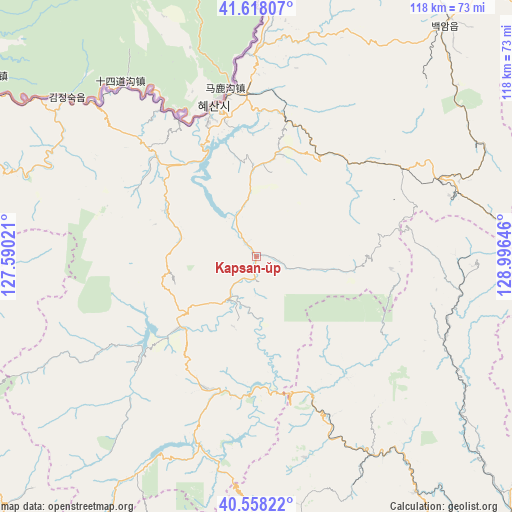
Kapsan-ŭp GPS coordinates[2]
41° 5' 25.008" North, 128° 17' 35.988" East
| Map corner | latitude | longitude |
|---|---|---|
| Upper-left | 41.61807°, | 127.59021° |
| Center: | 41.09028°, | 128.29333° |
| Lower-right: | 40.55822°, | 128.99646° |
| Map W x H: | 117.8×117.8 km | = 73.2×73.2mi |
| max Lat: | 42.95722° ⇑36.3% North |
| Kapsan-ŭp: | 41.09028° |
| min Lat: | ⇓63.7% South 37.90889° |
| min Long | Kapsan-ŭp | max Long |
| 124.39806° | 128.29333° | 130.49522° |
| W 64.8%⇐ | ⇒35.2% E |
Elevation
Elevation of Kapsan-ŭp is 813 m = 2667 ft, and this is 681.3 m = 2235 ft above average elevation for this country.
| Max E: |
1466 m = 4810 ft | 1.1% |
| Kapsan-ŭp | 813 m 2667 ft | |
| Avg. | 131.7 m = 432 ft | |
Min E: |
1 m = 3 ft | 98.9% |
See also: North Korea elevation on elevation.city.
Geographical zone
Kapsan-ŭp is located in North temperate zone (between Tropic of Cancer and the Arctic Circle). Distance of this Northern Tropic circle is 1962.9 km =1219.7 mi to South.| Distance of | km | miles | from Kapsan-ŭp |
|---|---|---|---|
| North Pole | 5438.3 | 3379.2 | to North |
| Arctic Circle | 2832.4 | 1760 | to North |
| Tropic Cancer | 1962.9 | 1219.7 | to South |
| Equator | 4568.8 | 2838.9 | to South |


Nearby cities:
15 places around Kapsan-ŭp: (largest is in red/bold)
• Hau-ri
99.3 km =61.7 mi,  82°
82°
• Hoemul-li
121.2 km =75.3 mi,  71°
71°
• Hongwŏn
121.8 km =75.7 mi,  193°
193°
• Hyesan
35.9 km =22.3 mi,  344°
344°
• Hyesan-dong
35.5 km =22.1 mi, 344°
• Iwŏn-ŭp
90.6 km =56.3 mi,  160°
160°
• Kilju
87.9 km =54.6 mi,  99°
99°
• Kimch’aek-si
88.7 km =55.1 mi,  121°
121°
• Kyŏngsŏng
122.8 km =76.3 mi,  63°
63°
• Nanam
135.1 km =83.9 mi, 59°
• Samho-rodongjagu
132 km =82 mi,  195°
195°
• Sŭngam-nodongjagu
131.6 km =81.8 mi, 60°
• Sŭngjibaegam
45.6 km =28.3 mi, 68°
• Yuktae-dong
119 km =73.9 mi, 185°
• Yŏnggwang-ŭp
138.7 km =86.2 mi,  210°
210°
Sources, notices
• [Note1] Compared only with cities in North Korea existing in our database
• [Src1] Map data: © OpenStreetMap contributors (CC-BY-SA)
• [Src2] Other city data from geonames.org with taken over terms of usage.
• [Src3] Geographical zone / Annual Mean Temperature by Robert A. Rohde @ Wikipedia
