Kilju geodata
Kilju (Hamgyŏng-bukto) is a populated place; located in North Korea in Asia/Pyongyang (GMT+9) time zone. With population of 63,652 people, there are 21 cities with bigger population in this country. Compared to other cities in North Korea, 59.3% of cities are located further ↓South; 71.4% of cities are located further ←West and 71.4% of cities have lower elevation than Kilju. Note1


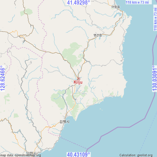
Kilju GPS coordinates[2]
40° 57' 51.012" North, 129° 19' 40.008" East
| Map corner | latitude | longitude |
|---|---|---|
| Upper-left | 41.49298°, | 128.62466° |
| Center: | 40.96417°, | 129.32778° |
| Lower-right: | 40.43109°, | 130.03091° |
| Map W x H: | 118.1×118.1 km | = 73.4×73.4mi |
| max Lat: | 42.95722° ⇑40.7% North |
| Kilju: | 40.96417° |
| min Lat: | ⇓59.3% South 37.90889° |
| min Long | Kilju | max Long |
| 124.39806° | 129.32778° | 130.49522° |
| W 71.4%⇐ | ⇒28.6% E |
Elevation
Elevation of Kilju is 129 m = 423 ft, and this is 2.7 m = 9 ft below average elevation for this country.
| Max E: |
1466 m = 4810 ft | 28.6% |
| Avg. | 131.7 m = 432 ft | |
| Kilju | 129 m = 423 ft | |
Min E: |
1 m = 3 ft | 71.4% |
See also: Kilju elevation on elevation.city.
Geographical zone
Kilju is located in North temperate zone (between Tropic of Cancer and the Arctic Circle). Distance of this Northern Tropic circle is 1948.9 km =1211 mi to South.| Distance of | km | miles | from Kilju |
|---|---|---|---|
| North Pole | 5452.3 | 3387.9 | to North |
| Arctic Circle | 2846.4 | 1768.7 | to North |
| Tropic Cancer | 1948.9 | 1211 | to South |
| Equator | 4554.8 | 2830.2 | to South |


Nearby cities:
15 places around Kilju: (largest is in red/bold)
• Chongjin
99.7 km =62 mi,  22°
22°
• Hau-ri
28.9 km =18 mi, 24°
• Hoemul-li
59.6 km =37 mi,  28°
28°
• Hyesan
107.8 km =67 mi,  296°
296°
• Hyesan-dong
107.6 km =66.9 mi, 296°
• Iwŏn-ŭp
91.1 km =56.6 mi,  218°
218°
• Kapsan-ŭp
87.9 km =54.6 mi,  279°
279°
• Kimch’aek-si
34.8 km =21.6 mi,  199°
199°
• Komusan Il-tong
131 km =81.4 mi,  13°
13°
• Kyŏngsŏng
73.1 km =45.4 mi, 18°
• Namsan
140.6 km =87.4 mi,  357°
357°
• Nanam
88.5 km =55 mi, 19°
• Puryŏng
126 km =78.3 mi, 14°
• Sŭngam-nodongjagu
83.5 km =51.9 mi, 19°
• Sŭngjibaegam
54.1 km =33.6 mi, 304°
Sources, notices
• [Note1] Compared only with cities in North Korea existing in our database
• [Src1] Map data: © OpenStreetMap contributors (CC-BY-SA)
• [Src2] Other city data from geonames.org with taken over terms of usage.
• [Src3] Geographical zone / Annual Mean Temperature by Robert A. Rohde @ Wikipedia
