Sŭngjibaegam geodata
Sŭngjibaegam (Yanggang-do) is a populated place; located in North Korea in Asia/Pyongyang (GMT+9) time zone. With population of 11,786 people, there are 69 cities with bigger population in this country. Compared to other cities in North Korea, 67% of cities are located further ↓South; 67% of cities are located further ←West and 100% of cities have lower elevation than Sŭngjibaegam. Note1


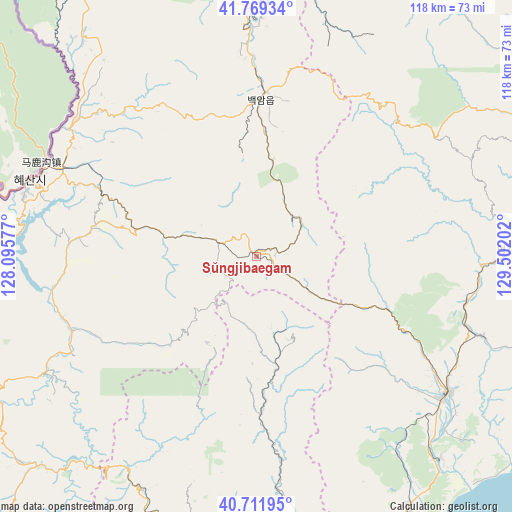
Sŭngjibaegam GPS coordinates[2]
41° 14' 34.008" North, 128° 47' 56.004" East
| Map corner | latitude | longitude |
|---|---|---|
| Upper-left | 41.76934°, | 128.09577° |
| Center: | 41.24278°, | 128.79889° |
| Lower-right: | 40.71195°, | 129.50202° |
| Map W x H: | 117.6×117.6 km | = 73.1×73.1mi |
| max Lat: | 42.95722° ⇑33% North |
| Sŭngjibaegam: | 41.24278° |
| min Lat: | ⇓67% South 37.90889° |
| min Long | Sŭngjibaegam | max Long |
| 124.39806° | 128.79889° | 130.49522° |
| W 67%⇐ | ⇒33% E |
Elevation
Elevation of Sŭngjibaegam is 1466 m = 4810 ft, and this is 1334.3 m = 4378 ft above average elevation for this country.
| Max E: |
1466 m = 4810 ft | 0% |
| Sŭngjibaegam | 1466 m 4810 ft | |
| Avg. | 131.7 m = 432 ft | |
Min E: |
1 m = 3 ft | 100% |
See also: North Korea elevation on elevation.city.
Geographical zone
Sŭngjibaegam is located in North temperate zone (between Tropic of Cancer and the Arctic Circle). Distance of this Northern Tropic circle is 1979.8 km =1230.2 mi to South.| Distance of | km | miles | from Sŭngjibaegam |
|---|---|---|---|
| North Pole | 5421.3 | 3368.6 | to North |
| Arctic Circle | 2815.4 | 1749.4 | to North |
| Tropic Cancer | 1979.8 | 1230.2 | to South |
| Equator | 4585.8 | 2849.5 | to South |


Nearby cities:
15 places around Sŭngjibaegam: (largest is in red/bold)
• Chongjin
101.9 km =63.3 mi,  52°
52°
• Hau-ri
56.3 km =35 mi,  94°
94°
• Hoemul-li
75.8 km =47.1 mi,  73°
73°
• Hyesan
54.8 km =34.1 mi,  288°
288°
• Hyesan-dong
54.6 km =33.9 mi, 288°
• Iwŏn-ŭp
103 km =64 mi,  186°
186°
• Kapsan-ŭp
45.6 km =28.3 mi,  248°
248°
• Kilju
54.1 km =33.6 mi,  124°
124°
• Kimch’aek-si
71.8 km =44.6 mi,  152°
152°
• Kyŏngsŏng
77.5 km =48.2 mi,  60°
60°
• Musan-ŭp
114.5 km =71.1 mi,  17°
17°
• Namsan
115.8 km =72 mi, 19°
• Nanam
90.5 km =56.2 mi, 54°
• Puryŏng
118.4 km =73.6 mi,  39°
39°
• Sŭngam-nodongjagu
86.7 km =53.9 mi, 56°
Sources, notices
• [Note1] Compared only with cities in North Korea existing in our database
• [Src1] Map data: © OpenStreetMap contributors (CC-BY-SA)
• [Src2] Other city data from geonames.org with taken over terms of usage.
• [Src3] Geographical zone / Annual Mean Temperature by Robert A. Rohde @ Wikipedia
