Hyesan geodata
Hyesan (Yanggang-do) is a seat of a first-order administrative division; located in North Korea in Asia/Pyongyang (GMT+9) time zone. With population of 192,680 people, there are 12 cities with bigger population in this country. Compared to other cities in North Korea, 69.2% of cities are located further ↓South; 62.6% of cities are located further ←West and 96.7% of cities have lower elevation than Hyesan. Note1


Hyesan GPS coordinates[2]
41° 24' 6.012" North, 128° 10' 40.008" East
| Map corner | latitude | longitude |
|---|---|---|
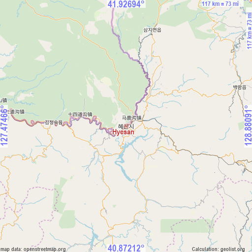
| Upper-left | 41.92694°, | 127.47466° |
| Center: | 41.40167°, | 128.17778° |
| Lower-right: | 40.87212°, | 128.88091° |
| Map W x H: | 117.3×117.3 km | = 72.9×72.9mi |
| max Lat: | 42.95722° ⇑30.8% North |
| Hyesan: | 41.40167° |
| min Lat: | ⇓69.2% South 37.90889° |
| min Long | Hyesan | max Long |
| 124.39806° | 128.17778° | 130.49522° |
| W 62.6%⇐ | ⇒37.4% E |
Elevation
Elevation of Hyesan is 709 m = 2326 ft, and this is 577.3 m = 1894 ft above average elevation for this country.
| Max E: |
1466 m = 4810 ft | 3.3% |
| Hyesan | 709 m 2326 ft | |
| Avg. | 131.7 m = 432 ft | |
Min E: |
1 m = 3 ft | 96.7% |
See also: Hyesan elevation on elevation.city.
Geographical zone
Hyesan is located in North temperate zone (between Tropic of Cancer and the Arctic Circle). Distance of this Northern Tropic circle is 1997.5 km =1241.2 mi to South.| Distance of | km | miles | from Hyesan |
|---|---|---|---|
| North Pole | 5403.6 | 3357.6 | to North |
| Arctic Circle | 2797.7 | 1738.4 | to North |
| Tropic Cancer | 1997.5 | 1241.2 | to South |
| Equator | 4603.4 | 2860.4 | to South |


Nearby cities:
15 places around Hyesan: (largest is in red/bold)
• Chasŏng
128.2 km =79.7 mi,  272°
272°
• Chongjin
139.9 km =86.9 mi,  71°
71°
• Hau-ri
110.3 km =68.5 mi,  101°
101°
• Hoemul-li
124.5 km =77.4 mi,  88°
88°
• Hyesan-dong
0.5 km =0.3 mi,  170°
170°
• Iwŏn-ŭp
126.5 km =78.6 mi,  161°
161°
• Kapsan-ŭp
35.9 km =22.3 mi, 164°
• Kilju
107.8 km =67 mi,  116°
116°
• Kimch’aek-si
117.6 km =73.1 mi,  133°
133°
• Kyŏngsŏng
120.7 km =75 mi,  80°
80°
• Musan-ŭp
125.3 km =77.9 mi,  42°
42°
• Namsan
128 km =79.5 mi, 44°
• Nanam
130.1 km =80.8 mi, 74°
• Sŭngam-nodongjagu
127.6 km =79.3 mi, 76°
• Sŭngjibaegam
54.8 km =34.1 mi,  108°
108°
Sources, notices
• [Note1] Compared only with cities in North Korea existing in our database
• [Src1] Map data: © OpenStreetMap contributors (CC-BY-SA)
• [Src2] Other city data from geonames.org with taken over terms of usage.
• [Src3] Geographical zone / Annual Mean Temperature by Robert A. Rohde @ Wikipedia
