Hŭngju-dong geodata
Hŭngju-dong (Chagang-do) is a seat of a third-order administrative division; located in North Korea in Asia/Pyongyang (GMT+9) time zone. In our database, there are 78 cities with bigger population. Compared to other cities in North Korea, 62.6% of cities are located further ↓South; 58.2% of cities are located further →East and 87.9% of cities have lower elevation than Hŭngju-dong. Note1


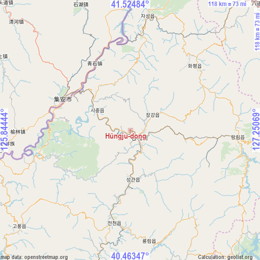
Hŭngju-dong GPS coordinates[2]
40° 59' 46.644" North, 126° 32' 51.216" East
| Map corner | latitude | longitude |
|---|---|---|
| Upper-left | 41.52484°, | 125.84444° |
| Center: | 40.99629°, | 126.54756° |
| Lower-right: | 40.46347°, | 127.25069° |
| Map W x H: | 118×118 km | = 73.3×73.3mi |
| max Lat: | 42.95722° ⇑37.4% North |
| Hŭngju-dong: | 40.99629° |
| min Lat: | ⇓62.6% South 37.90889° |
| min Long | Hŭngju-dong | max Long |
| 124.39806° | 126.54756° | 130.49522° |
| W 41.8%⇐ | ⇒58.2% E |
Elevation
Elevation of Hŭngju-dong is 297 m = 974 ft, and this is 165.3 m = 542 ft above average elevation for this country.
| Max E: |
1466 m = 4810 ft | 12.1% |
| Hŭngju-dong | 297 m 974 ft | |
| Avg. | 131.7 m = 432 ft | |
Min E: |
1 m = 3 ft | 87.9% |
See also: North Korea elevation on elevation.city.
Geographical zone
Hŭngju-dong is located in North temperate zone (between Tropic of Cancer and the Arctic Circle). Distance of this Northern Tropic circle is 1952.4 km =1213.2 mi to South.| Distance of | km | miles | from Hŭngju-dong |
|---|---|---|---|
| North Pole | 5448.7 | 3385.7 | to North |
| Arctic Circle | 2842.8 | 1766.4 | to North |
| Tropic Cancer | 1952.4 | 1213.2 | to South |
| Equator | 4558.4 | 2832.5 | to South |


Nearby cities:
15 places around Hŭngju-dong: (largest is in red/bold)
• Chasŏng
52.2 km =32.4 mi,  8°
8°
• Hamhŭng
146.2 km =90.8 mi,  145°
145°
• Hyesan
143.6 km =89.2 mi,  71°
71°
• Hyesan-dong
143.6 km =89.2 mi, 71°
• Hŭngnam
158.1 km =98.2 mi, 145°
• Kanggye
4.3 km =2.7 mi,  133°
133°
• Kapsan-ŭp
146.8 km =91.2 mi,  85°
85°
• Kujang-ŭp
133 km =82.6 mi,  199°
199°
• Kusŏng
157.7 km =98 mi,  224°
224°
• Manp’o
27.9 km =17.3 mi,  309°
309°
• Pukchil-lodongjagu
111.1 km =69 mi, 217°
• Sakchu-ŭp
143.4 km =89.1 mi,  241°
241°
• Yŏngbyŏn
145.8 km =90.6 mi,  205°
205°
• Yŏnggwang-ŭp
133.1 km =82.7 mi,  144°
144°
• Ŭijin-dong
4.9 km =3 mi, 241°
Sources, notices
• [Note1] Compared only with cities in North Korea existing in our database
• [Src1] Map data: © OpenStreetMap contributors (CC-BY-SA)
• [Src2] Other city data from geonames.org with taken over terms of usage.
• [Src3] Geographical zone / Annual Mean Temperature by Robert A. Rohde @ Wikipedia
