Kanggye geodata
Kanggye (Chagang-do) is a seat of a first-order administrative division; located in North Korea in Asia/Pyongyang (GMT+9) time zone. With population of 209,530 people, there are 11 cities with bigger population in this country. Compared to other cities in North Korea, 60.4% of cities are located further ↓South; 56% of cities are located further →East and 85.7% of cities have lower elevation than Kanggye. Note1


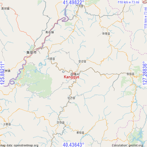
Kanggye GPS coordinates[2]
40° 58' 10.056" North, 126° 35' 6.828" East
| Map corner | latitude | longitude |
|---|---|---|
| Upper-left | 41.49822°, | 125.88211° |
| Center: | 40.96946°, | 126.58523° |
| Lower-right: | 40.43643°, | 127.28836° |
| Map W x H: | 118.1×118.1 km | = 73.4×73.4mi |
| max Lat: | 42.95722° ⇑39.6% North |
| Kanggye: | 40.96946° |
| min Lat: | ⇓60.4% South 37.90889° |
| min Long | Kanggye | max Long |
| 124.39806° | 126.58523° | 130.49522° |
| W 44%⇐ | ⇒56% E |
Elevation
Elevation of Kanggye is 288 m = 945 ft, and this is 156.3 m = 513 ft above average elevation for this country.
| Max E: |
1466 m = 4810 ft | 14.3% |
| Kanggye | 288 m 945 ft | |
| Avg. | 131.7 m = 432 ft | |
Min E: |
1 m = 3 ft | 85.7% |
See also: Kanggye elevation on elevation.city.
Geographical zone
Kanggye is located in North temperate zone (between Tropic of Cancer and the Arctic Circle). Distance of this Northern Tropic circle is 1949.5 km =1211.4 mi to South.| Distance of | km | miles | from Kanggye |
|---|---|---|---|
| North Pole | 5451.7 | 3387.5 | to North |
| Arctic Circle | 2845.8 | 1768.3 | to North |
| Tropic Cancer | 1949.5 | 1211.4 | to South |
| Equator | 4555.4 | 2830.6 | to South |


Nearby cities:
15 places around Kanggye: (largest is in red/bold)
• Chasŏng
54.8 km =34.1 mi,  4°
4°
• Hamhŭng
141.9 km =88.2 mi,  145°
145°
• Hongwŏn
156.4 km =97.2 mi,  132°
132°
• Hyesan
141.7 km =88 mi,  70°
70°
• Hyesan-dong
141.6 km =88 mi, 70°
• Hŭngju-dong
4.3 km =2.7 mi,  313°
313°
• Hŭngnam
153.8 km =95.6 mi, 145°
• Kapsan-ŭp
143.9 km =89.4 mi,  84°
84°
• Kujang-ŭp
131.3 km =81.6 mi,  200°
200°
• Manp’o
32.2 km =20 mi, 309°
• Pukchil-lodongjagu
110.8 km =68.8 mi,  219°
219°
• Sakchu-ŭp
144.9 km =90 mi,  243°
243°
• Yŏngbyŏn
144.6 km =89.9 mi,  207°
207°
• Yŏnggwang-ŭp
128.8 km =80 mi, 145°
• Ŭijin-dong
7.5 km =4.7 mi,  274°
274°
Sources, notices
• [Note1] Compared only with cities in North Korea existing in our database
• [Src1] Map data: © OpenStreetMap contributors (CC-BY-SA)
• [Src2] Other city data from geonames.org with taken over terms of usage.
• [Src3] Geographical zone / Annual Mean Temperature by Robert A. Rohde @ Wikipedia
