Manp’o geodata
Manp’o (Chagang-do) is a populated place; located in North Korea in Asia/Pyongyang (GMT+9) time zone. With population of 116,760 people, there are 14 cities with bigger population in this country. Compared to other cities in North Korea, 64.8% of cities are located further ↓South; 60.4% of cities are located further →East and 79.1% of cities have lower elevation than Manp’o. Note1


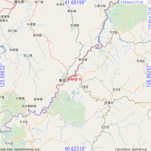
Manp’o GPS coordinates[2]
41° 9' 16.992" North, 126° 17' 21.984" East
| Map corner | latitude | longitude |
|---|---|---|
| Upper-left | 41.68199°, | 125.58632° |
| Center: | 41.15472°, | 126.28944° |
| Lower-right: | 40.62318°, | 126.99257° |
| Map W x H: | 117.7×117.7 km | = 73.1×73.1mi |
| max Lat: | 42.95722° ⇑35.2% North |
| Manp’o: | 41.15472° |
| min Lat: | ⇓64.8% South 37.90889° |
| min Long | Manp’o | max Long |
| 124.39806° | 126.28944° | 130.49522° |
| W 39.6%⇐ | ⇒60.4% E |
Elevation
Elevation of Manp’o is 206 m = 676 ft, and this is 74.3 m = 244 ft above average elevation for this country.
| Max E: |
1466 m = 4810 ft | 20.9% |
| Manp’o | 206 m 676 ft | |
| Avg. | 131.7 m = 432 ft | |
Min E: |
1 m = 3 ft | 79.1% |
See also: Manp’o elevation on elevation.city.
Geographical zone
Manp’o is located in North temperate zone (between Tropic of Cancer and the Arctic Circle). Distance of this Northern Tropic circle is 1970.1 km =1224.2 mi to South.| Distance of | km | miles | from Manp’o |
|---|---|---|---|
| North Pole | 5431.1 | 3374.7 | to North |
| Arctic Circle | 2825.2 | 1755.5 | to North |
| Tropic Cancer | 1970.1 | 1224.2 | to South |
| Equator | 4576 | 2843.4 | to South |


Nearby cities:
15 places around Manp’o: (largest is in red/bold)
• Chasŏng
45 km =28 mi,  40°
40°
• Hamhŭng
173.2 km =107.6 mi,  142°
142°
• Hyesan
160.2 km =99.5 mi,  80°
80°
• Hyesan-dong
160.2 km =99.5 mi, 80°
• Hŭngju-dong
27.9 km =17.3 mi,  129°
129°
• Kanggye
32.2 km =20 mi, 129°
• Kapsan-ŭp
168 km =104.4 mi,  92°
92°
• Kujang-ŭp
144.8 km =90 mi,  188°
188°
• Kusŏng
157.5 km =97.9 mi,  214°
214°
• Panghyŏn-dong
166.5 km =103.5 mi, 212°
• Pukchil-lodongjagu
115.3 km =71.6 mi,  203°
203°
• Sakchu-ŭp
134.9 km =83.8 mi,  230°
230°
• Yŏngbyŏn
154.7 km =96.1 mi, 195°
• Yŏnggwang-ŭp
160.1 km =99.5 mi, 142°
• Ŭijin-dong
26.4 km =16.4 mi, 139°
Sources, notices
• [Note1] Compared only with cities in North Korea existing in our database
• [Src1] Map data: © OpenStreetMap contributors (CC-BY-SA)
• [Src2] Other city data from geonames.org with taken over terms of usage.
• [Src3] Geographical zone / Annual Mean Temperature by Robert A. Rohde @ Wikipedia
