Sinhyeon geodata
Sinhyeon (Gyeongsangnam-do) is a populated place; located in South Korea in Asia/Seoul (GMT+9) time zone. With population of 82,560 people, there are 58 cities with bigger population in this country. Compared to other cities in South Korea, 87.8% of cities are located further ↑North; 88.1% of cities are located further ←West and 84.3% of cities have higher elevation than Sinhyeon. Note1


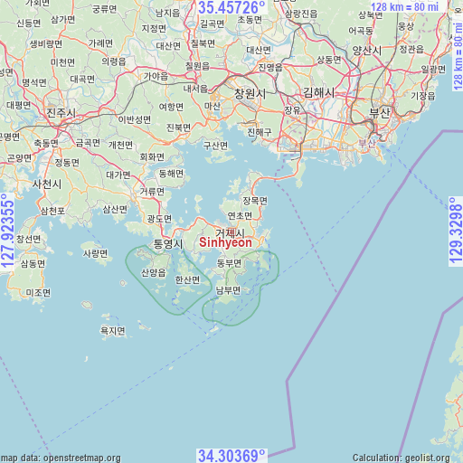
Sinhyeon GPS coordinates[2]
34° 52' 57" North, 128° 37' 36.012" East
| Map corner | latitude | longitude |
|---|---|---|
| Upper-left | 35.45726°, | 127.92355° |
| Center: | 34.8825°, | 128.62667° |
| Lower-right: | 34.30369°, | 129.3298° |
| Map W x H: | 128.3×128.3 km | = 79.7×79.7mi |
| max Lat: | 38.37881° ⇑87.8% North |
| Sinhyeon: | 34.8825° |
| min Lat: | ⇓12.2% South 33.25333° |
| min Long | Sinhyeon | max Long |
| 126.10863° | 128.62667° | 129.55377° |
| W 88.1%⇐ | ⇒11.9% E |
Elevation
Elevation of Sinhyeon is 14 m = 46 ft, and this is 56.4 m = 185 ft below average elevation for this country.
| Max E: |
691 m = 2267 ft | 84.3% |
| Avg. | 70.4 m = 231 ft | |
| Sinhyeon | 14 m = 46 ft | |
Min E: |
1 m = 3 ft | 15.7% |
See also: Sinhyeon elevation on elevation.city.
Geographical zone
Sinhyeon is located in North temperate zone (between Tropic of Cancer and the Arctic Circle). Distance of this Northern Tropic circle is 1272.7 km =790.8 mi to South.| Distance of | km | miles | from Sinhyeon |
|---|---|---|---|
| North Pole | 6128.5 | 3808.1 | to North |
| Arctic Circle | 3522.6 | 2188.8 | to North |
| Tropic Cancer | 1272.7 | 790.8 | to South |
| Equator | 3878.6 | 2410 | to South |


Nearby cities:
15 places around Sinhyeon: (largest is in red/bold)
• Busan
44.1 km =27.4 mi,  56°
56°
• Changwon
38.7 km =24 mi,  7°
7°
• Chinju
60.2 km =37.4 mi,  304°
304°
• Dongnae
54.8 km =34.1 mi,  49°
49°
• Gijang
66.9 km =41.6 mi, 53°
• Goseong
29.5 km =18.3 mi,  290°
290°
• Kimhae
45.4 km =28.2 mi,  30°
30°
• Kyosai
5 km =3.1 mi,  224°
224°
• Mijo
56.3 km =35 mi,  250°
250°
• Miryang
68.8 km =42.8 mi, 9°
• Naesŏ
42 km =26.1 mi,  346°
346°
• Nammyeon
68.6 km =42.6 mi,  259°
259°
• Oepo
10.4 km =6.5 mi, 51°
• Sangju
61.2 km =38 mi, 253°
• Yangsan
63.1 km =39.2 mi,  35°
35°
Sources, notices
• [Note1] Compared only with cities in South Korea existing in our database
• [Src1] Map data: © OpenStreetMap contributors (CC-BY-SA)
• [Src2] Other city data from geonames.org with taken over terms of usage.
• [Src3] Geographical zone / Annual Mean Temperature by Robert A. Rohde @ Wikipedia
