Muang Kènthao geodata
Muang Kènthao (Xiagnabouli) is a seat of a second-order administrative division; located in Laos in Asia/Vientiane (GMT+7) time zone. In our database, there are 24 cities with bigger population. Compared to other cities in Laos, 61.5% of cities are located further ↑North; 92.3% of cities are located further →East and 55.8% of cities have higher elevation than Muang Kènthao. Note1


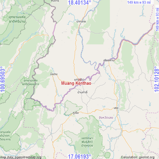
Muang Kènthao GPS coordinates[2]
17° 43' 58.404" North, 101° 23' 53.34" East
| Map corner | latitude | longitude |
|---|---|---|
| Upper-left | 18.40134°, | 100.69503° |
| Center: | 17.73289°, | 101.39815° |
| Lower-right: | 17.06193°, | 102.10128° |
| Map W x H: | 148.9×148.9 km | = 92.5×92.5mi |
| max Lat: | 21.6808° ⇑61.5% North |
| Muang Kènthao: | 17.73289° |
| min Lat: | ⇓38.5% South 14.11785° |
| min Long | Muang Kènthao | max Long |
| 100.4178° | 101.39815° | 107.26667° |
| W 7.7%⇐ | ⇒92.3% E |
Elevation
Elevation of Muang Kènthao is 242 m = 794 ft, and this is 231.6 m = 760 ft below average elevation for this country.
| Max E: |
1722 m = 5650 ft | 55.8% |
| Avg. | 473.6 m = 1554 ft | |
| Muang Kènthao | 242 m = 794 ft | |
Min E: |
83 m = 272 ft | 44.2% |
See also: Laos elevation on elevation.city.
Geographical zone
Muang Kènthao is located in North Torrid zone (between Equator and Tropic of Cancer). Distance of this Northern Tropic circle is 634.2 km =394.1 mi to North.| Distance of | km | miles | from Muang Kènthao |
|---|---|---|---|
| North Pole | 8035.3 | 4992.9 | to North |
| Arctic Circle | 5429.5 | 3373.7 | to North |
| Tropic Cancer | 634.2 | 394.1 | to North |
| Equator | 1971.7 | 1225.2 | to South |


Nearby cities:
15 places around Muang Kènthao: (largest is in red/bold)
• Ban Houakhoua
296.6 km =184.3 mi,  340°
340°
• Ban Houayxay
300.3 km =186.6 mi, 339°
• Ban Nahin
303 km =188.3 mi,  79°
79°
• Ban Xiang-Ngeun
239.9 km =149.1 mi,  20°
20°
• Borikhan
262.8 km =163.3 mi,  69°
69°
• Luang Prabang
251.7 km =156.4 mi, 17°
• Muang Kasi
189.2 km =117.6 mi,  28°
28°
• Muang Phôn-Hông
136.9 km =85.1 mi,  51°
51°
• Muang Phônsavan
268.6 km =166.9 mi,  44°
44°
• Muang Sanakham
35.2 km =21.9 mi,  55°
55°
• Pakkading
282.2 km =175.4 mi, 76°
• Pakxan
250.3 km =155.5 mi, 72°
• Sainyabuli
172.7 km =107.3 mi,  10°
10°
• Vangviang
172.6 km =107.2 mi, 39°
• Vientiane
129.8 km =80.7 mi, 78°
Sources, notices
• [Note1] Compared only with cities in Laos existing in our database
• [Src1] Map data: © OpenStreetMap contributors (CC-BY-SA)
• [Src2] Other city data from geonames.org with taken over terms of usage.
• [Src3] Geographical zone / Annual Mean Temperature by Robert A. Rohde @ Wikipedia
