Vientiane geodata
Vientiane (Vientiane Prefecture) is a capital of a political entity; located in Laos in Asia/Vientiane (GMT+7) time zone. With population of 196,731 people, there are 0 cities with bigger population in this country. Compared to other cities in Laos, 57.7% of cities are located further ↑North; 65.4% of cities are located further →East and 69.2% of cities have higher elevation than Vientiane. Note1


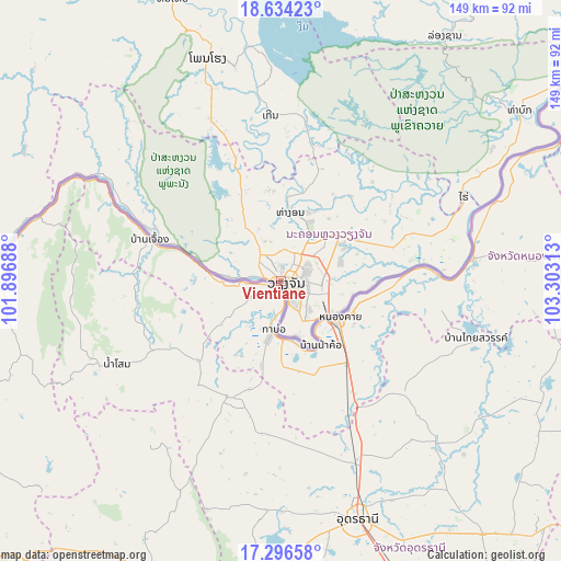
Vientiane GPS coordinates[2]
17° 58' 0.012" North, 102° 36' 0" East
| Map corner | latitude | longitude |
|---|---|---|
| Upper-left | 18.63423°, | 101.89688° |
| Center: | 17.96667°, | 102.6° |
| Lower-right: | 17.29658°, | 103.30313° |
| Map W x H: | 148.7×148.7 km | = 92.4×92.4mi |
| max Lat: | 21.6808° ⇑57.7% North |
| Vientiane: | 17.96667° |
| min Lat: | ⇓42.3% South 14.11785° |
| min Long | Vientiane | max Long |
| 100.4178° | 102.6° | 107.26667° |
| W 34.6%⇐ | ⇒65.4% E |
Elevation
Elevation of Vientiane is 174 m = 571 ft, and this is 299.6 m = 983 ft below average elevation for this country.
| Max E: |
1722 m = 5650 ft | 69.2% |
| Avg. | 473.6 m = 1554 ft | |
| Vientiane | 174 m = 571 ft | |
Min E: |
83 m = 272 ft | 30.8% |
See also: Vientiane elevation on elevation.city.
Geographical zone
Vientiane is located in North Torrid zone (between Equator and Tropic of Cancer). Distance of this Northern Tropic circle is 608.2 km =377.9 mi to North.| Distance of | km | miles | from Vientiane |
|---|---|---|---|
| North Pole | 8009.4 | 4976.8 | to North |
| Arctic Circle | 5403.5 | 3357.6 | to North |
| Tropic Cancer | 608.2 | 377.9 | to North |
| Equator | 1997.7 | 1241.3 | to South |


Nearby cities:
15 places around Vientiane: (largest is in red/bold)
• Ban Nahin
173.2 km =107.6 mi,  79°
79°
• Ban Xiang-Ngeun
204 km =126.8 mi,  347°
347°
• Borikhan
136.2 km =84.6 mi,  60°
60°
• Luang Prabang
218.9 km =136 mi, 347°
• Muang Hinboun
216.2 km =134.3 mi,  101°
101°
• Muang Kasi
145.1 km =90.2 mi, 345°
• Muang Kènthao
129.8 km =80.7 mi,  258°
258°
• Muang Mok
181.7 km =112.9 mi,  54°
54°
• Muang Phôn-Hông
61.9 km =38.5 mi,  341°
341°
• Muang Phônsavan
176.2 km =109.5 mi,  20°
20°
• Muang Sanakham
98.2 km =61 mi,  266°
266°
• Pakkading
152.5 km =94.8 mi,  74°
74°
• Pakxan
121.8 km =75.7 mi, 67°
• Sainyabuli
171.4 km =106.5 mi,  326°
326°
• Vangviang
107.6 km =66.9 mi, 351°
Sources, notices
• [Note1] Compared only with cities in Laos existing in our database
• [Src1] Map data: © OpenStreetMap contributors (CC-BY-SA)
• [Src2] Other city data from geonames.org with taken over terms of usage.
• [Src3] Geographical zone / Annual Mean Temperature by Robert A. Rohde @ Wikipedia
