Borikhan geodata
Borikhan (Bolikhamsai) is a seat of a second-order administrative division; located in Laos in Asia/Vientiane (GMT+7) time zone. In our database, there are 24 cities with bigger population. Compared to other cities in Laos, 53.8% of cities are located further ↓South; 55.8% of cities are located further →East and 71.2% of cities have higher elevation than Borikhan. Note1


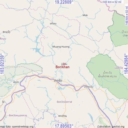
Borikhan GPS coordinates[2]
18° 33' 46.296" North, 103° 43' 36.156" East
| Map corner | latitude | longitude |
|---|---|---|
| Upper-left | 19.22809°, | 103.02359° |
| Center: | 18.56286°, | 103.72671° |
| Lower-right: | 17.89503°, | 104.42984° |
| Map W x H: | 148.2×148.2 km | = 92.1×92.1mi |
| max Lat: | 21.6808° ⇑46.2% North |
| Borikhan: | 18.56286° |
| min Lat: | ⇓53.8% South 14.11785° |
| min Long | Borikhan | max Long |
| 100.4178° | 103.72671° | 107.26667° |
| W 44.2%⇐ | ⇒55.8% E |
Elevation
Elevation of Borikhan is 165 m = 541 ft, and this is 308.6 m = 1012 ft below average elevation for this country.
| Max E: |
1722 m = 5650 ft | 71.2% |
| Avg. | 473.6 m = 1554 ft | |
| Borikhan | 165 m = 541 ft | |
Min E: |
83 m = 272 ft | 28.8% |
See also: Laos elevation on elevation.city.
Geographical zone
Borikhan is located in North Torrid zone (between Equator and Tropic of Cancer). Distance of this Northern Tropic circle is 541.9 km =336.7 mi to North.| Distance of | km | miles | from Borikhan |
|---|---|---|---|
| North Pole | 7943.1 | 4935.6 | to North |
| Arctic Circle | 5337.2 | 3316.4 | to North |
| Tropic Cancer | 541.9 | 336.7 | to North |
| Equator | 2064 | 1282.5 | to South |


Nearby cities:
15 places around Borikhan: (largest is in red/bold)
• Ban Nahin
62.4 km =38.8 mi,  124°
124°
• Huameung
176.9 km =109.9 mi,  4°
4°
• Muang Hinboun
142.4 km =88.5 mi,  139°
139°
• Muang Kasi
171.8 km =106.8 mi,  295°
295°
• Muang Khamkeut
112.4 km =69.8 mi,  109°
109°
• Muang Mok
48.5 km =30.1 mi,  37°
37°
• Muang Phôn-Hông
138.5 km =86.1 mi,  266°
266°
• Muang Phônsavan
113.5 km =70.5 mi,  330°
330°
• Pakkading
38.7 km =24 mi,  133°
133°
• Pakxan
20 km =12.4 mi,  200°
200°
• Thakhèk
173.4 km =107.7 mi, 137°
• Vangviang
140.5 km =87.3 mi,  286°
286°
• Viengthong
199.1 km =123.7 mi,  350°
350°
• Vientiane
136.2 km =84.6 mi,  240°
240°
• Xamtay
174.7 km =108.6 mi,  28°
28°
Sources, notices
• [Note1] Compared only with cities in Laos existing in our database
• [Src1] Map data: © OpenStreetMap contributors (CC-BY-SA)
• [Src2] Other city data from geonames.org with taken over terms of usage.
• [Src3] Geographical zone / Annual Mean Temperature by Robert A. Rohde @ Wikipedia
