Kuliyapitiya geodata
Kuliyapitiya (North Western) is a populated place; located in Sri Lanka in Asia/Colombo (GMT+5.5) time zone. With population of 6,877 people, there are 64 cities with bigger population in this country. Compared to other cities in Sri Lanka, 75% of cities are located further ↓South; 61.8% of cities are located further →East and 65.8% of cities have lower elevation than Kuliyapitiya. Note1
Administrative division(s):
- Level 1: North Western
- Level 2: Kurunegala District
- Level 3: Kuliyapitiya West Division
- Level 4: Kuliyapitiya Town


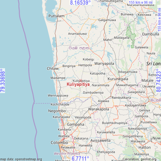
Kuliyapitiya GPS coordinates[2]
7° 28' 7.68" North, 80° 2' 24.36" East
| Map corner | latitude | longitude |
|---|---|---|
| Upper-left | 8.16539°, | 79.33698° |
| Center: | 7.4688°, | 80.0401° |
| Lower-right: | 6.7711°, | 80.74323° |
| Map W x H: | 155×155 km | = 96.3×96.3mi |
| max Lat: | 9.81667° ⇑25% North |
| Kuliyapitiya: | 7.4688° |
| min Lat: | ⇓75% South 5.92825° |
| min Long | Kuliyapitiya | max Long |
| 79.79528° | 80.0401° | 81.83472° |
| W 38.2%⇐ | ⇒61.8% E |
Elevation
Elevation of Kuliyapitiya is 33 m = 108 ft, and this is 124.4 m = 408 ft below average elevation for this country.
| Max E: |
1868 m = 6129 ft | 34.2% |
| Avg. | 157.4 m = 516 ft | |
| Kuliyapitiya | 33 m = 108 ft | |
Min E: |
1 m = 3 ft | 65.8% |
See also: Sri Lanka elevation on elevation.city.
Geographical zone
Kuliyapitiya is located in North Torrid zone (between Equator and Tropic of Cancer). Distance of Equator is 830.5 km =516 mi to South.| Distance of | km | miles | from Kuliyapitiya |
|---|---|---|---|
| North Pole | 9176.6 | 5702.1 | to North |
| Arctic Circle | 6570.7 | 4082.8 | to North |
| Tropic Cancer | 1775.5 | 1103.2 | to North |
| Equator | 830.5 | 516 | to South |


Nearby cities:
15 places around Kuliyapitiya: (largest is in red/bold)
• Chilaw
29.5 km =18.3 mi,  293°
293°
• Gampaha
42.5 km =26.4 mi,  187°
187°
• Hendala
55.9 km =34.7 mi,  198°
198°
• Ja Ela
46.8 km =29.1 mi, 200°
• Kadugannawa
58.5 km =36.4 mi,  114°
114°
• Kandana
49.5 km =30.8 mi, 199°
• Katunayaka
37.2 km =23.1 mi,  206°
206°
• Kegalle
41.2 km =25.6 mi,  125°
125°
• Kelaniya
58.6 km =36.4 mi, 192°
• Kurunegala
36.2 km =22.5 mi,  87°
87°
• Minuwangoda
35 km =21.7 mi, 195°
• Negombo
36.7 km =22.8 mi,  217°
217°
• Peliyagoda
58.2 km =36.2 mi, 197°
• Wattala
55.8 km =34.7 mi, 197°
• Welisara
51.3 km =31.9 mi, 197°
Sources, notices
• [Note1] Compared only with cities in Sri Lanka existing in our database
• [Src1] Map data: © OpenStreetMap contributors (CC-BY-SA)
• [Src2] Other city data from geonames.org with taken over terms of usage.
• [Src3] Geographical zone / Annual Mean Temperature by Robert A. Rohde @ Wikipedia
