Kegalle geodata
Kegalle (Sabaragamuwa) is a populated place; located in Sri Lanka in Asia/Colombo (GMT+5.5) time zone. With population of 17,962 people, there are 52 cities with bigger population in this country. Compared to other cities in Sri Lanka, 68.4% of cities are located further ↓South; 53.9% of cities are located further ←West and 82.9% of cities have lower elevation than Kegalle. Note1
Administrative division(s):
- Level 1: Sabaragamuwa
- Level 2: Kegalle District
- Level 3: Kegalla Division
- Level 4: Golahela


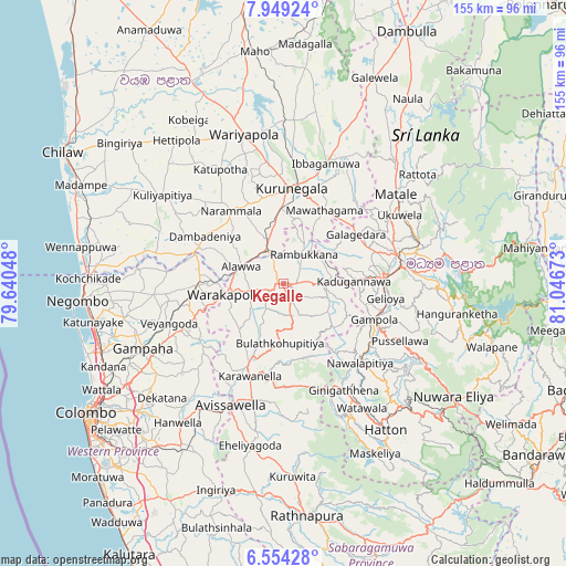
Kegalle GPS coordinates[2]
7° 15' 8.28" North, 80° 20' 36.96" East
| Map corner | latitude | longitude |
|---|---|---|
| Upper-left | 7.94924°, | 79.64048° |
| Center: | 7.2523°, | 80.3436° |
| Lower-right: | 6.55428°, | 81.04673° |
| Map W x H: | 155.1×155.1 km | = 96.4×96.4mi |
| max Lat: | 9.81667° ⇑31.6% North |
| Kegalle: | 7.2523° |
| min Lat: | ⇓68.4% South 5.92825° |
| min Long | Kegalle | max Long |
| 79.79528° | 80.3436° | 81.83472° |
| W 53.9%⇐ | ⇒46.1% E |
Elevation
Elevation of Kegalle is 176 m = 577 ft, and this is 18.6 m = 61 ft above average elevation for this country.
| Max E: |
1868 m = 6129 ft | 17.1% |
| Kegalle | 176 m 577 ft | |
| Avg. | 157.4 m = 516 ft | |
Min E: |
1 m = 3 ft | 82.9% |
See also: Sri Lanka elevation on elevation.city.
Geographical zone
Kegalle is located in North Torrid zone (between Equator and Tropic of Cancer). Distance of Equator is 806.4 km =501.1 mi to South.| Distance of | km | miles | from Kegalle |
|---|---|---|---|
| North Pole | 9200.7 | 5717 | to North |
| Arctic Circle | 6594.8 | 4097.8 | to North |
| Tropic Cancer | 1799.5 | 1118.2 | to North |
| Equator | 806.4 | 501.1 | to South |


Nearby cities:
15 places around Kegalle: (largest is in red/bold)
• Gampaha
42.7 km =26.5 mi,  244°
244°
• Gampola
26.8 km =16.7 mi,  111°
111°
• Hanwella Ihala
48.3 km =30 mi,  216°
216°
• Hatton
48.8 km =30.3 mi,  145°
145°
• Ja Ela
53.6 km =33.3 mi,  248°
248°
• Kadugannawa
19.9 km =12.4 mi,  89°
89°
• Kandana
54.6 km =33.9 mi, 245°
• Kandy
32.3 km =20.1 mi,  82°
82°
• Katunayaka
51 km =31.7 mi,  259°
259°
• Kuliyapitiya
41.2 km =25.6 mi,  305°
305°
• Kurunegala
25.9 km =16.1 mi,  6°
6°
• Matale
39.1 km =24.3 mi,  51°
51°
• Minuwangoda
44.1 km =27.4 mi, 257°
• Talawakele
49.3 km =30.6 mi,  135°
135°
• Welisara
54.8 km =34.1 mi, 242°
Sources, notices
• [Note1] Compared only with cities in Sri Lanka existing in our database
• [Src1] Map data: © OpenStreetMap contributors (CC-BY-SA)
• [Src2] Other city data from geonames.org with taken over terms of usage.
• [Src3] Geographical zone / Annual Mean Temperature by Robert A. Rohde @ Wikipedia
