Jaffna geodata
Jaffna (Northern Province) is a seat of a first-order administrative division; located in Sri Lanka in Asia/Colombo (GMT+5.5) time zone. With population of 169,102 people, there are 3 cities with bigger population in this country. Compared to other cities in Sri Lanka, 97.4% of cities are located further ↓South; 63.2% of cities are located further →East and 92.1% of cities have higher elevation than Jaffna. Note1


Jaffna GPS coordinates[2]
9° 40' 6.42" North, 80° 0' 26.712" East
| Map corner | latitude | longitude |
|---|---|---|
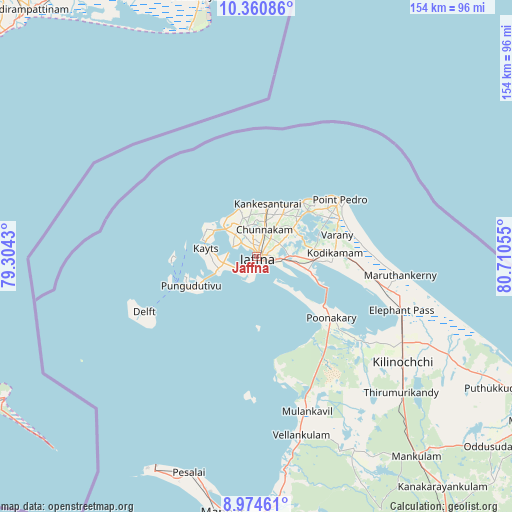
| Upper-left | 10.36086°, | 79.3043° |
| Center: | 9.66845°, | 80.00742° |
| Lower-right: | 8.97461°, | 80.71055° |
| Map W x H: | 154.1×154.1 km | = 95.8×95.8mi |
| max Lat: | 9.81667° ⇑2.6% North |
| Jaffna: | 9.66845° |
| min Lat: | ⇓97.4% South 5.92825° |
| min Long | Jaffna | max Long |
| 79.79528° | 80.00742° | 81.83472° |
| W 36.8%⇐ | ⇒63.2% E |
Elevation
Elevation of Jaffna is 7 m = 23 ft, and this is 150.4 m = 493 ft below average elevation for this country.
| Max E: |
1868 m = 6129 ft | 92.1% |
| Avg. | 157.4 m = 516 ft | |
| Jaffna | 7 m = 23 ft | |
Min E: |
1 m = 3 ft | 7.9% |
See also: Jaffna elevation on elevation.city.
Geographical zone
Jaffna is located in North Torrid zone (between Equator and Tropic of Cancer). Distance of Equator is 1075 km =668 mi to South.| Distance of | km | miles | from Jaffna |
|---|---|---|---|
| North Pole | 8932 | 5550.1 | to North |
| Arctic Circle | 6326.1 | 3930.9 | to North |
| Tropic Cancer | 1530.9 | 951.3 | to North |
| Equator | 1075 | 668 | to South |


Nearby cities:
15 places around Jaffna: (largest is in red/bold)
• Anuradhapura
157.2 km =97.7 mi,  163°
163°
• Chilaw
233.8 km =145.3 mi,  185°
185°
• Dambulla
213.2 km =132.5 mi, 160°
• Kilinochchi
52.5 km =32.6 mi,  125°
125°
• Kuliyapitiya
244.6 km =152 mi,  179°
179°
• Mihintale
155.7 km =96.7 mi, 159°
• Padaviya Divisional Secretariat
123.5 km =76.7 mi,  137°
137°
• Point Pedro
29.7 km =18.5 mi,  56°
56°
• Polonnaruwa
221.2 km =137.4 mi,  150°
150°
• Puttalam
182.6 km =113.5 mi, 186°
• Sigiriya
207.8 km =129.1 mi, 156°
• Trincomalee
180.8 km =112.3 mi, 132°
• Vakarai
231.7 km =144 mi, 137°
• Valvedditturai
24 km =14.9 mi,  46°
46°
• Vavuniya
115.3 km =71.6 mi, 152°
Sources, notices
• [Note1] Compared only with cities in Sri Lanka existing in our database
• [Src1] Map data: © OpenStreetMap contributors (CC-BY-SA)
• [Src2] Other city data from geonames.org with taken over terms of usage.
• [Src3] Geographical zone / Annual Mean Temperature by Robert A. Rohde @ Wikipedia
