Mihintale geodata
Mihintale (North Central) is a populated place; located in Sri Lanka in Asia/Colombo (GMT+5.5) time zone. With population of 5,000 people, there are 65 cities with bigger population in this country. Compared to other cities in Sri Lanka, 90.8% of cities are located further ↓South; 64.5% of cities are located further ←West and 77.6% of cities have lower elevation than Mihintale. Note1
Administrative division(s):
- Level 1: North Central
- Level 2: Anuradhapura District
- Level 3: Mihinthale
- Level 4: Mihinthale


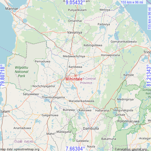
Mihintale GPS coordinates[2]
8° 21' 33.48" North, 80° 30' 37.08" East
| Map corner | latitude | longitude |
|---|---|---|
| Upper-left | 9.05432°, | 79.80718° |
| Center: | 8.3593°, | 80.5103° |
| Lower-right: | 7.66304°, | 81.21343° |
| Map W x H: | 154.7×154.7 km | = 96.1×96.1mi |
| max Lat: | 9.81667° ⇑9.2% North |
| Mihintale: | 8.3593° |
| min Lat: | ⇓90.8% South 5.92825° |
| min Long | Mihintale | max Long |
| 79.79528° | 80.5103° | 81.83472° |
| W 64.5%⇐ | ⇒35.5% E |
Elevation
Elevation of Mihintale is 113 m = 371 ft, and this is 44.4 m = 146 ft below average elevation for this country.
| Max E: |
1868 m = 6129 ft | 22.4% |
| Avg. | 157.4 m = 516 ft | |
| Mihintale | 113 m = 371 ft | |
Min E: |
1 m = 3 ft | 77.6% |
See also: Sri Lanka elevation on elevation.city.
Geographical zone
Mihintale is located in North Torrid zone (between Equator and Tropic of Cancer). Distance of Equator is 929.5 km =577.6 mi to South.| Distance of | km | miles | from Mihintale |
|---|---|---|---|
| North Pole | 9077.6 | 5640.6 | to North |
| Arctic Circle | 6471.7 | 4021.3 | to North |
| Tropic Cancer | 1676.5 | 1041.7 | to North |
| Equator | 929.5 | 577.6 | to South |


Nearby cities:
15 places around Mihintale: (largest is in red/bold)
• Anuradhapura
11.9 km =7.4 mi,  243°
243°
• Chilaw
117.4 km =72.9 mi,  222°
222°
• Dambulla
57.7 km =35.9 mi,  164°
164°
• Kandy
119.6 km =74.3 mi,  173°
173°
• Kilinochchi
115.9 km =72 mi,  353°
353°
• Kuliyapitiya
111.7 km =69.4 mi,  207°
207°
• Kurunegala
98.6 km =61.3 mi,  189°
189°
• Matale
99.7 km =62 mi, 172°
• Padaviya Divisional Secretariat
60.7 km =37.7 mi,  27°
27°
• Polonnaruwa
71.5 km =44.4 mi,  130°
130°
• Puttalam
83.2 km =51.7 mi, 244°
• Sigiriya
52.7 km =32.7 mi,  149°
149°
• Trincomalee
82.7 km =51.4 mi,  72°
72°
• Vakarai
104.6 km =65 mi,  103°
103°
• Vavuniya
43.6 km =27.1 mi,  358°
358°
Sources, notices
• [Note1] Compared only with cities in Sri Lanka existing in our database
• [Src1] Map data: © OpenStreetMap contributors (CC-BY-SA)
• [Src2] Other city data from geonames.org with taken over terms of usage.
• [Src3] Geographical zone / Annual Mean Temperature by Robert A. Rohde @ Wikipedia
