Sigiriya geodata
Sigiriya (Central) is a populated place; located in Sri Lanka in Asia/Colombo (GMT+5.5) time zone. With population of 1,001 people, there are 75 cities with bigger population in this country. Compared to other cities in Sri Lanka, 85.5% of cities are located further ↓South; 77.6% of cities are located further ←West and 86.8% of cities have lower elevation than Sigiriya. Note1
Administrative division(s):
- Level 1: Central
- Level 2: Matale District
- Level 3: Dambulla
- Level 4: Sigiriya


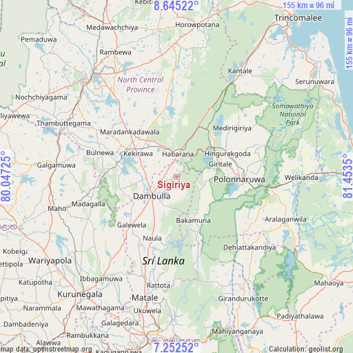
Sigiriya GPS coordinates[2]
7° 56' 58.056" North, 80° 45' 1.332" East
| Map corner | latitude | longitude |
|---|---|---|
| Upper-left | 8.64522°, | 80.04725° |
| Center: | 7.94946°, | 80.75037° |
| Lower-right: | 7.25252°, | 81.4535° |
| Map W x H: | 154.9×154.9 km | = 96.3×96.3mi |
| max Lat: | 9.81667° ⇑14.5% North |
| Sigiriya: | 7.94946° |
| min Lat: | ⇓85.5% South 5.92825° |
| min Long | Sigiriya | max Long |
| 79.79528° | 80.75037° | 81.83472° |
| W 77.6%⇐ | ⇒22.4% E |
Elevation
Elevation of Sigiriya is 207 m = 679 ft, and this is 49.6 m = 163 ft above average elevation for this country.
| Max E: |
1868 m = 6129 ft | 13.2% |
| Sigiriya | 207 m 679 ft | |
| Avg. | 157.4 m = 516 ft | |
Min E: |
1 m = 3 ft | 86.8% |
See also: Sri Lanka elevation on elevation.city.
Geographical zone
Sigiriya is located in North Torrid zone (between Equator and Tropic of Cancer). Distance of Equator is 883.9 km =549.2 mi to South.| Distance of | km | miles | from Sigiriya |
|---|---|---|---|
| North Pole | 9123.2 | 5668.9 | to North |
| Arctic Circle | 6517.3 | 4049.7 | to North |
| Tropic Cancer | 1722 | 1070 | to North |
| Equator | 883.9 | 549.2 | to South |


Nearby cities:
15 places around Sigiriya: (largest is in red/bold)
• Anuradhapura
54.8 km =34.1 mi,  317°
317°
• Dambulla
14.7 km =9.1 mi,  227°
227°
• Eravur Town
95.9 km =59.6 mi,  101°
101°
• Gampola
89.5 km =55.6 mi,  192°
192°
• Kadugannawa
81.2 km =50.5 mi,  197°
197°
• Kandy
74.4 km =46.2 mi, 189°
• Kegalle
89.5 km =55.6 mi,  210°
210°
• Kuliyapitiya
94.8 km =58.9 mi,  235°
235°
• Kurunegala
66.7 km =41.4 mi,  219°
219°
• Matale
55.2 km =34.3 mi, 194°
• Mihintale
52.7 km =32.7 mi,  329°
329°
• Polonnaruwa
27.8 km =17.3 mi,  92°
92°
• Trincomalee
87.5 km =54.4 mi,  37°
37°
• Vakarai
77.9 km =48.4 mi,  74°
74°
• Vavuniya
93.4 km =58 mi,  342°
342°
Sources, notices
• [Note1] Compared only with cities in Sri Lanka existing in our database
• [Src1] Map data: © OpenStreetMap contributors (CC-BY-SA)
• [Src2] Other city data from geonames.org with taken over terms of usage.
• [Src3] Geographical zone / Annual Mean Temperature by Robert A. Rohde @ Wikipedia
