Pasvalys geodata
Pasvalys (Panevėžys) is a populated place; located in Lithuania in Europe/Vilnius (GMT+3) time zone. With population of 8,510 people, there are 52 cities with bigger population in this country. Compared to other cities in Lithuania, 91% of cities are located further ↓South; 63.4% of cities are located further ←West and 86.6% of cities have higher elevation than Pasvalys. Note1


Pasvalys GPS coordinates[2]
56° 3' 33.984" North, 24° 24' 12.996" East
| Map corner | latitude | longitude |
|---|---|---|
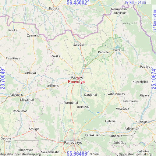
| Upper-left | 56.45002°, | 23.70049° |
| Center: | 56.05944°, | 24.40361° |
| Lower-right: | 55.66486°, | 25.10674° |
| Map W x H: | 87.3×87.3 km | = 54.2×54.2mi |
| max Lat: | 56.36149° ⇑9% North |
| Pasvalys: | 56.05944° |
| min Lat: | ⇓91% South 54.01573° |
| min Long | Pasvalys | max Long |
| 20.99651° | 24.40361° | 26.43984° |
| W 63.4%⇐ | ⇒36.6% E |
Elevation
Elevation of Pasvalys is 35 m = 115 ft, and this is 55.7 m = 183 ft below average elevation for this country.
| Max E: |
204 m = 669 ft | 86.6% |
| Avg. | 90.7 m = 298 ft | |
| Pasvalys | 35 m = 115 ft | |
Min E: |
-1 m = -3 ft | 13.4% |
See also: Lithuania elevation on elevation.city.
Geographical zone
Pasvalys is located in North temperate zone (between Tropic of Cancer and the Arctic Circle). Distance of this North polar circle is 1167.9 km =725.7 mi to North.| Distance of | km | miles | from Pasvalys |
|---|---|---|---|
| North Pole | 3773.8 | 2344.9 | to North |
| Arctic Circle | 1167.9 | 725.7 | to North |
| Tropic Cancer | 3627.3 | 2253.9 | to South |
| Equator | 6233.2 | 3873.1 | to South |


Nearby cities:
15 places around Pasvalys: (largest is in red/bold)
• Anyksciai
73.7 km =45.8 mi,  143°
143°
• Birzai
26.6 km =16.5 mi,  53°
53°
• Joniškis
52.8 km =32.8 mi,  292°
292°
• Kupiskis
43.4 km =27 mi,  124°
124°
• Linkuva
27 km =16.8 mi,  276°
276°
• Naujamiestis
44.3 km =27.5 mi,  200°
200°
• Obeliai
47.9 km =29.8 mi,  102°
102°
• Pakruojis
35.2 km =21.9 mi,  255°
255°
• Pandėlys
51.2 km =31.8 mi,  94°
94°
• Panevėžys
36.4 km =22.6 mi,  185°
185°
• Radviliskis
60.5 km =37.6 mi,  243°
243°
• Ramygala
61 km =37.9 mi, 186°
• Vabalninkas
23.1 km =14.4 mi,  112°
112°
• Šeduva
53.1 km =33 mi,  229°
229°
• Šiauliai
69 km =42.9 mi, 258°
Sources, notices
• [Note1] Compared only with cities in Lithuania existing in our database
• [Src1] Map data: © OpenStreetMap contributors (CC-BY-SA)
• [Src2] Other city data from geonames.org with taken over terms of usage.
• [Src3] Geographical zone / Annual Mean Temperature by Robert A. Rohde @ Wikipedia
