Echternach geodata
Echternach is a seat of a second-order administrative division; located in Luxembourg in Europe/Luxembourg (GMT+2) time zone. With population of 4,787 people, there are 15 cities with bigger population in this country. Compared to other cities in Luxembourg, 81.4% of cities are located further ↓South; 96% of cities are located further ←West and 93.8% of cities have higher elevation than Echternach. Note1


Echternach GPS coordinates[2]
49° 48' 43.632" North, 6° 25' 6.456" East
| Map corner | latitude | longitude |
|---|---|---|
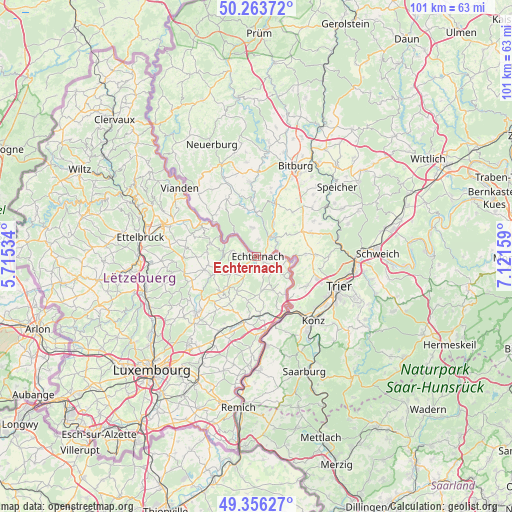
| Upper-left | 50.26372°, | 5.71534° |
| Center: | 49.81212°, | 6.41846° |
| Lower-right: | 49.35627°, | 7.12159° |
| Map W x H: | 100.9×100.9 km | = 62.7×62.7mi |
| max Lat: | 50.13722° ⇑18.6% North |
| Echternach: | 49.81212° |
| min Lat: | ⇓81.4% South 49.45964° |
| min Long | Echternach | max Long |
| 5.76583° | 6.41846° | 6.50532° |
| W 96%⇐ | ⇒4% E |
Elevation
Elevation of Echternach is 168 m = 551 ft, and this is 114 m = 374 ft below average elevation for this country.
| Max E: |
502 m = 1647 ft | 93.8% |
| Avg. | 282 m = 925 ft | |
| Echternach | 168 m = 551 ft | |
Min E: |
143 m = 469 ft | 6.2% |
See also: Luxembourg elevation on elevation.city.
Geographical zone
Echternach is located in North temperate zone (between Tropic of Cancer and the Arctic Circle). Distance of this North polar circle is 1862.6 km =1157.4 mi to North.| Distance of | km | miles | from Echternach |
|---|---|---|---|
| North Pole | 4468.5 | 2776.6 | to North |
| Arctic Circle | 1862.6 | 1157.4 | to North |
| Tropic Cancer | 2932.7 | 1822.3 | to South |
| Equator | 5538.6 | 3441.5 | to South |


Nearby cities:
15 places around Echternach: (largest is in red/bold)
• Beaufort
9.5 km =5.9 mi,  286°
286°
• Bech
7.7 km =4.8 mi,  210°
210°
• Berbourg
9.2 km =5.7 mi,  191°
191°
• Berdorf
5 km =3.1 mi,  280°
280°
• Biwer
12.3 km =7.6 mi,  195°
195°
• Consdorf
6.7 km =4.2 mi,  237°
237°
• Manternach
12.2 km =7.6 mi,  177°
177°
• Mertert
12.9 km =8 mi,  160°
160°
• Mompach
8.1 km =5 mi, 155°
• Reisdorf
12.5 km =7.8 mi,  300°
300°
• Rosport
6.3 km =3.9 mi,  97°
97°
• Steinheim
4.3 km =2.7 mi,  81°
81°
• Waldbillig
9.8 km =6.1 mi,  259°
259°
• Wasserbillig
12.2 km =7.6 mi,  151°
151°
• Wecker
13.3 km =8.3 mi, 190°
Sources, notices
• [Note1] Compared only with cities in Luxembourg existing in our database
• [Src1] Map data: © OpenStreetMap contributors (CC-BY-SA)
• [Src2] Other city data from geonames.org with taken over terms of usage.
• [Src3] Geographical zone / Annual Mean Temperature by Robert A. Rohde @ Wikipedia
