Oued Zem geodata
Oued Zem (Béni Mellal-Khénifra) is a seat of a third-order administrative division; located in Morocco in Africa/Casablanca (GMT+1) time zone. With population of 84,910 people, there are 28 cities with bigger population in this country. Compared to other cities in Morocco, 53.1% of cities are located further ↑North; 58.9% of cities are located further →East and 63.6% of cities have lower elevation than Oued Zem. Note1
Administrative division(s):
- Level 1: Béni Mellal-Khénifra
- Level 2: Khouribga Province
- Level 3: Oued Zem


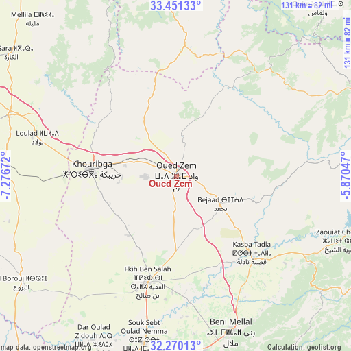
Oued Zem GPS coordinates[2]
32° 51' 45.72" North, 6° 34' 24.924" West
| Map corner | latitude | longitude |
|---|---|---|
| Upper-left | 33.45133°, | -7.27672° |
| Center: | 32.8627°, | -6.57359° |
| Lower-right: | 32.27013°, | -5.87047° |
| Map W x H: | 131.3×131.3 km | = 81.6×81.6mi |
| max Lat: | 35.84906° ⇑53.1% North |
| Oued Zem: | 32.8627° |
| min Lat: | ⇓46.9% South 22.6558° |
| min Long | Oued Zem | max Long |
| -15.60719° | -6.57359° | -1.22855° |
| W 41.1%⇐ | ⇒58.9% E |
Elevation
Elevation of Oued Zem is 783 m = 2569 ft, and this is 166.2 m = 545 ft above average elevation for this country.
| Max E: |
2637 m = 8652 ft | 36.4% |
| Oued Zem | 783 m 2569 ft | |
| Avg. | 616.8 m = 2024 ft | |
Min E: |
1 m = 3 ft | 63.6% |
See also: Oued Zem elevation on elevation.city.
Geographical zone
Oued Zem is located in North temperate zone (between Tropic of Cancer and the Arctic Circle). Distance of this Northern Tropic circle is 1048.1 km =651.3 mi to South.| Distance of | km | miles | from Oued Zem |
|---|---|---|---|
| North Pole | 6353.1 | 3947.6 | to North |
| Arctic Circle | 3747.2 | 2328.4 | to North |
| Tropic Cancer | 1048.1 | 651.3 | to South |
| Equator | 3654 | 2270.5 | to South |


Nearby cities:
15 places around Oued Zem: (largest is in red/bold)
• Aguelmous
75.5 km =46.9 mi,  63°
63°
• Al Fqih Ben Çalah
41.5 km =25.8 mi,  194°
194°
• Beni Mellal
62.1 km =38.6 mi,  160°
160°
• Boujniba
19.2 km =11.9 mi,  282°
282°
• Dar Ould Zidouh
68.6 km =42.6 mi,  206°
206°
• El Ksiba
61 km =37.9 mi,  121°
121°
• Ezzhiliga
48.8 km =30.3 mi,  4°
4°
• Isseksi
75.7 km =47 mi, 158°
• Kasba Tadla
41 km =25.5 mi,  135°
135°
• Khouribga
31.1 km =19.3 mi,  273°
273°
• Sidi Amar
69.9 km =43.4 mi,  82°
82°
• Sidi Jaber
54.5 km =33.9 mi, 164°
• Sidi Lamine
49.1 km =30.5 mi, 84°
• Timoulilt
74 km =46 mi,  172°
172°
• Zawyat ech Cheïkh
65.9 km =40.9 mi,  111°
111°
Sources, notices
• [Note1] Compared only with cities in Morocco existing in our database
• [Src1] Map data: © OpenStreetMap contributors (CC-BY-SA)
• [Src2] Other city data from geonames.org with taken over terms of usage.
• [Src3] Geographical zone / Annual Mean Temperature by Robert A. Rohde @ Wikipedia
