Sidi Yahya Ou Saad geodata
Sidi Yahya Ou Saad (Béni Mellal-Khénifra) is a seat of a third-order administrative division; located in Morocco in Africa/Casablanca (GMT+1) time zone. In our database, there are 108 cities with bigger population. Compared to other cities in Morocco, 56.6% of cities are located further ↑North; 57.8% of cities are located further ←West and 93.4% of cities have lower elevation than Sidi Yahya Ou Saad. Note1
Administrative division(s):
- Level 1: Béni Mellal-Khénifra
- Level 2: Khenifra
- Level 3: Sidi Yahya Ou Saad


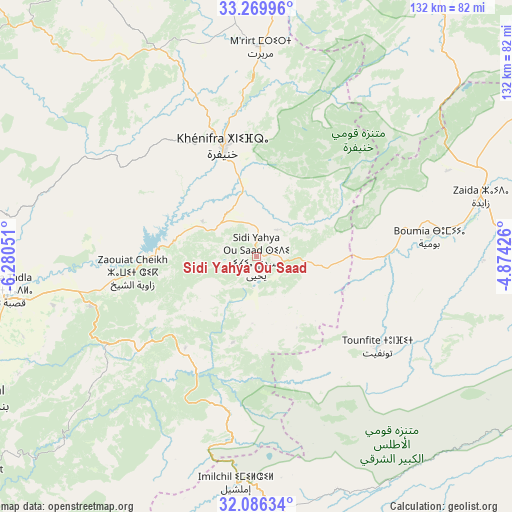
Sidi Yahya Ou Saad GPS coordinates[2]
32° 40' 48.396" North, 5° 34' 38.568" West
| Map corner | latitude | longitude |
|---|---|---|
| Upper-left | 33.26996°, | -6.28051° |
| Center: | 32.68011°, | -5.57738° |
| Lower-right: | 32.08634°, | -4.87426° |
| Map W x H: | 131.6×131.6 km | = 81.8×81.8mi |
| max Lat: | 35.84906° ⇑56.6% North |
| Sidi Yahya Ou Saad: | 32.68011° |
| min Lat: | ⇓43.4% South 22.6558° |
| min Long | Sidi Yahya Ou S | max Long |
| -15.60719° | -5.57738° | -1.22855° |
| W 57.8%⇐ | ⇒42.2% E |
Elevation
Elevation of Sidi Yahya Ou Saad is 1484 m = 4869 ft, and this is 867.2 m = 2845 ft above average elevation for this country.
| Max E: |
2637 m = 8652 ft | 6.6% |
| Sidi Yahya Ou Saad | 1484 m 4869 ft | |
| Avg. | 616.8 m = 2024 ft | |
Min E: |
1 m = 3 ft | 93.4% |
See also: Morocco elevation on elevation.city.
Geographical zone
Sidi Yahya Ou Saad is located in North temperate zone (between Tropic of Cancer and the Arctic Circle). Distance of this Northern Tropic circle is 1027.8 km =638.6 mi to South.| Distance of | km | miles | from Sidi Yahya Ou Saad |
|---|---|---|---|
| North Pole | 6373.4 | 3960.2 | to North |
| Arctic Circle | 3767.5 | 2341 | to North |
| Tropic Cancer | 1027.8 | 638.6 | to South |
| Equator | 3633.7 | 2257.9 | to South |


Nearby cities:
15 places around Sidi Yahya Ou Saad: (largest is in red/bold)
• Aguelmous
59.1 km =36.7 mi,  334°
334°
• Amouguer
75.2 km =46.7 mi,  126°
126°
• Anergui
76 km =47.2 mi,  206°
206°
• Aïn Leuh
71.4 km =44.4 mi,  18°
18°
• Boumia
44.7 km =27.8 mi,  83°
83°
• El Ksiba
43.1 km =26.8 mi,  253°
253°
• Imilchil
58.8 km =36.5 mi,  184°
184°
• Itzer
53.9 km =33.5 mi,  65°
65°
• Kasba Tadla
65.4 km =40.6 mi,  261°
261°
• Kerrouchen
27.4 km =17 mi,  61°
61°
• Khenifra
29.4 km =18.3 mi,  344°
344°
• Midelt
77.9 km =48.4 mi,  89°
89°
• Sidi Amar
38.3 km =23.8 mi,  321°
321°
• Sidi Lamine
51 km =31.7 mi,  299°
299°
• Zawyat ech Cheïkh
32.2 km =20 mi, 262°
Sources, notices
• [Note1] Compared only with cities in Morocco existing in our database
• [Src1] Map data: © OpenStreetMap contributors (CC-BY-SA)
• [Src2] Other city data from geonames.org with taken over terms of usage.
• [Src3] Geographical zone / Annual Mean Temperature by Robert A. Rohde @ Wikipedia
