Tan-Tan geodata
Tan-Tan (Guelmim-Oued Noun) is a seat of a second-order administrative division; located in Morocco in Africa/Casablanca (GMT+1) time zone. With population of 61,924 people, there are 42 cities with bigger population in this country. Compared to other cities in Morocco, 98.1% of cities are located further ↑North; 98.1% of cities are located further →East and 85.3% of cities have higher elevation than Tan-Tan. Note1


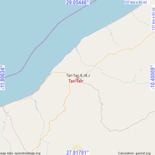
Tan-Tan GPS coordinates[2]
28° 26' 16.764" North, 11° 6' 11.556" West
| Map corner | latitude | longitude |
|---|---|---|
| Upper-left | 29.05446°, | -11.80634° |
| Center: | 28.43799°, | -11.10321° |
| Lower-right: | 27.81791°, | -10.40009° |
| Map W x H: | 137.5×137.5 km | = 85.4×85.4mi |
| max Lat: | 35.84906° ⇑98.1% North |
| Tan-Tan: | 28.43799° |
| min Lat: | ⇓1.9% South 22.6558° |
| min Long | Tan-Tan | max Long |
| -15.60719° | -11.10321° | -1.22855° |
| W 1.9%⇐ | ⇒98.1% E |
Elevation
Elevation of Tan-Tan is 45 m = 148 ft, and this is 571.8 m = 1876 ft below average elevation for this country.
| Max E: |
2637 m = 8652 ft | 85.3% |
| Avg. | 616.8 m = 2024 ft | |
| Tan-Tan | 45 m = 148 ft | |
Min E: |
1 m = 3 ft | 14.7% |
See also: Tan-Tan elevation on elevation.city.
Geographical zone
Tan-Tan is located in North temperate zone (between Tropic of Cancer and the Arctic Circle). Distance of this Northern Tropic circle is 556.1 km =345.5 mi to South.| Distance of | km | miles | from Tan-Tan |
|---|---|---|---|
| North Pole | 6845.1 | 4253.3 | to North |
| Arctic Circle | 4239.2 | 2634.1 | to North |
| Tropic Cancer | 556.1 | 345.5 | to South |
| Equator | 3162 | 1964.8 | to South |


Nearby cities:
15 places around Tan-Tan: (largest is in red/bold)
• Agadir
264.2 km =164.2 mi,  33°
33°
• Akhfennir
100.4 km =62.4 mi,  247°
247°
• Aourir
269 km =167.1 mi, 31°
• Dakhla
265.6 km =165 mi, 34°
• Guelmim
118.9 km =73.9 mi,  59°
59°
• Inezgane
261.7 km =162.6 mi,  35°
35°
• Ouijjane
201.5 km =125.2 mi,  48°
48°
• Reggada
186.3 km =115.8 mi, 47°
• Sidi Ifni
138.4 km =86 mi, 40°
• Smara
197.1 km =122.5 mi,  196°
196°
• Tafraout
251.5 km =156.3 mi, 55°
• Tanalt
239.7 km =148.9 mi, 51°
• Tarfaya
187 km =116.2 mi, 252°
• Tarsouat
238.6 km =148.3 mi, 57°
• Tiznit
193.3 km =120.1 mi, 43°
Sources, notices
• [Note1] Compared only with cities in Morocco existing in our database
• [Src1] Map data: © OpenStreetMap contributors (CC-BY-SA)
• [Src2] Other city data from geonames.org with taken over terms of usage.
• [Src3] Geographical zone / Annual Mean Temperature by Robert A. Rohde @ Wikipedia
