Reggada geodata
Reggada (Souss-Massa) is a seat of a third-order administrative division; located in Morocco in Africa/Casablanca (GMT+1) time zone. In our database, there are 108 cities with bigger population. Compared to other cities in Morocco, 96.9% of cities are located further ↑North; 95% of cities are located further →East and 55.8% of cities have higher elevation than Reggada. Note1


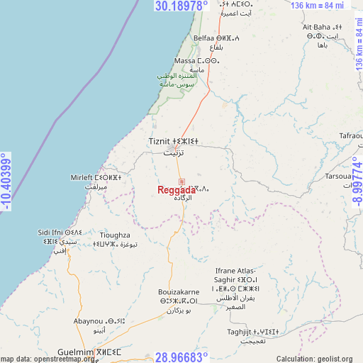
Reggada GPS coordinates[2]
29° 34' 48.576" North, 9° 42' 3.096" West
| Map corner | latitude | longitude |
|---|---|---|
| Upper-left | 30.18978°, | -10.40399° |
| Center: | 29.58016°, | -9.70086° |
| Lower-right: | 28.96683°, | -8.99774° |
| Map W x H: | 136×136 km | = 84.5×84.5mi |
| max Lat: | 35.84906° ⇑96.9% North |
| Reggada: | 29.58016° |
| min Lat: | ⇓3.1% South 22.6558° |
| min Long | Reggada | max Long |
| -15.60719° | -9.70086° | -1.22855° |
| W 5%⇐ | ⇒95% E |
Elevation
Elevation of Reggada is 387 m = 1270 ft, and this is 229.8 m = 754 ft below average elevation for this country.
| Max E: |
2637 m = 8652 ft | 55.8% |
| Avg. | 616.8 m = 2024 ft | |
| Reggada | 387 m = 1270 ft | |
Min E: |
1 m = 3 ft | 44.2% |
See also: Morocco elevation on elevation.city.
Geographical zone
Reggada is located in North temperate zone (between Tropic of Cancer and the Arctic Circle). Distance of this Northern Tropic circle is 683.1 km =424.5 mi to South.| Distance of | km | miles | from Reggada |
|---|---|---|---|
| North Pole | 6718.1 | 4174.4 | to North |
| Arctic Circle | 4112.2 | 2555.2 | to North |
| Tropic Cancer | 683.1 | 424.5 | to South |
| Equator | 3289 | 2043.7 | to South |


Nearby cities:
15 places around Reggada: (largest is in red/bold)
• Agadir
93.9 km =58.3 mi,  6°
6°
• Aourir
101.6 km =63.1 mi,  3°
3°
• Assads
108.6 km =67.5 mi,  48°
48°
• Dakhla
93.4 km =58 mi, 8°
• Guelmim
74.5 km =46.3 mi,  207°
207°
• Inezgane
87.6 km =54.4 mi, 10°
• Ouijjane
16.5 km =10.3 mi,  71°
71°
• Oulad Teïma
102.2 km =63.5 mi,  27°
27°
• Sidi Ifni
50.8 km =31.6 mi,  244°
244°
• Tabia
94.2 km =58.5 mi,  57°
57°
• Tafraout
72 km =44.7 mi,  77°
77°
• Taghazout
107 km =66.5 mi,  359°
359°
• Tanalt
55.9 km =34.7 mi, 67°
• Tarsouat
65.2 km =40.5 mi,  89°
89°
• Tiznit
13.4 km =8.3 mi,  347°
347°
Sources, notices
• [Note1] Compared only with cities in Morocco existing in our database
• [Src1] Map data: © OpenStreetMap contributors (CC-BY-SA)
• [Src2] Other city data from geonames.org with taken over terms of usage.
• [Src3] Geographical zone / Annual Mean Temperature by Robert A. Rohde @ Wikipedia
