Boumia geodata
Boumia (Béni Mellal-Khénifra) is a seat of a third-order administrative division; located in Morocco in Africa/Casablanca (GMT+1) time zone. In our database, there are 108 cities with bigger population. Compared to other cities in Morocco, 55.8% of cities are located further ↑North; 70.9% of cities are located further ←West and 93.8% of cities have lower elevation than Boumia. Note1


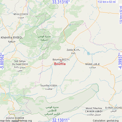
Boumia GPS coordinates[2]
32° 43' 24.96" North, 5° 6' 9" West
| Map corner | latitude | longitude |
|---|---|---|
| Upper-left | 33.31316°, | -5.80562° |
| Center: | 32.7236°, | -5.1025° |
| Lower-right: | 32.13011°, | -4.39937° |
| Map W x H: | 131.5×131.5 km | = 81.7×81.7mi |
| max Lat: | 35.84906° ⇑55.8% North |
| Boumia: | 32.7236° |
| min Lat: | ⇓44.2% South 22.6558° |
| min Long | Boumia | max Long |
| -15.60719° | -5.1025° | -1.22855° |
| W 70.9%⇐ | ⇒29.1% E |
Elevation
Elevation of Boumia is 1520 m = 4987 ft, and this is 903.2 m = 2963 ft above average elevation for this country.
| Max E: |
2637 m = 8652 ft | 6.2% |
| Boumia | 1520 m 4987 ft | |
| Avg. | 616.8 m = 2024 ft | |
Min E: |
1 m = 3 ft | 93.8% |
See also: Morocco elevation on elevation.city.
Geographical zone
Boumia is located in North temperate zone (between Tropic of Cancer and the Arctic Circle). Distance of this Northern Tropic circle is 1032.6 km =641.6 mi to South.| Distance of | km | miles | from Boumia |
|---|---|---|---|
| North Pole | 6368.5 | 3957.2 | to North |
| Arctic Circle | 3762.7 | 2338 | to North |
| Tropic Cancer | 1032.6 | 641.6 | to South |
| Equator | 3638.5 | 2260.9 | to South |


Nearby cities:
15 places around Boumia: (largest is in red/bold)
• Aguelmous
84.8 km =52.7 mi,  305°
305°
• Amersid
59.2 km =36.8 mi,  87°
87°
• Amouguer
52.3 km =32.5 mi,  162°
162°
• Assoul
86.3 km =53.6 mi,  186°
186°
• Azrou
79.8 km =49.6 mi,  352°
352°
• Aïn Leuh
66.7 km =41.4 mi,  340°
340°
• Boulemane
79.2 km =49.2 mi,  26°
26°
• Imilchil
80.1 km =49.8 mi,  217°
217°
• Itzer
17.8 km =11.1 mi,  15°
15°
• Kerrouchen
21.8 km =13.5 mi,  291°
291°
• Khenifra
57.3 km =35.6 mi, 294°
• Midelt
33.7 km =20.9 mi,  97°
97°
• Sidi Amar
72.7 km =45.2 mi, 290°
• Sidi Yahya Ou Saad
44.7 km =27.8 mi,  263°
263°
• Zawyat ech Cheïkh
76.8 km =47.7 mi, 263°
Sources, notices
• [Note1] Compared only with cities in Morocco existing in our database
• [Src1] Map data: © OpenStreetMap contributors (CC-BY-SA)
• [Src2] Other city data from geonames.org with taken over terms of usage.
• [Src3] Geographical zone / Annual Mean Temperature by Robert A. Rohde @ Wikipedia
