Khouribga geodata
Khouribga (Béni Mellal-Khénifra) is a seat of a third-order administrative division; located in Morocco in Africa/Casablanca (GMT+1) time zone. With population of 167,673 people, there are 15 cities with bigger population in this country. Compared to other cities in Morocco, 52.3% of cities are located further ↑North; 63.6% of cities are located further →East and 64.3% of cities have lower elevation than Khouribga. Note1
Administrative division(s):
- Level 1: Béni Mellal-Khénifra
- Level 2: Khouribga Province
- Level 3: Khouribga


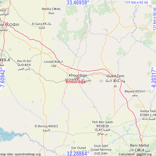
Khouribga GPS coordinates[2]
32° 52' 51.888" North, 6° 54' 22.68" West
| Map corner | latitude | longitude |
|---|---|---|
| Upper-left | 33.46959°, | -7.60942° |
| Center: | 32.88108°, | -6.9063° |
| Lower-right: | 32.28864°, | -6.20317° |
| Map W x H: | 131.3×131.3 km | = 81.6×81.6mi |
| max Lat: | 35.84906° ⇑52.3% North |
| Khouribga: | 32.88108° |
| min Lat: | ⇓47.7% South 22.6558° |
| min Long | Khouribga | max Long |
| -15.60719° | -6.9063° | -1.22855° |
| W 36.4%⇐ | ⇒63.6% E |
Elevation
Elevation of Khouribga is 804 m = 2638 ft, and this is 187.2 m = 614 ft above average elevation for this country.
| Max E: |
2637 m = 8652 ft | 35.7% |
| Khouribga | 804 m 2638 ft | |
| Avg. | 616.8 m = 2024 ft | |
Min E: |
1 m = 3 ft | 64.3% |
See also: Khouribga elevation on elevation.city.
Geographical zone
Khouribga is located in North temperate zone (between Tropic of Cancer and the Arctic Circle). Distance of this Northern Tropic circle is 1050.1 km =652.5 mi to South.| Distance of | km | miles | from Khouribga |
|---|---|---|---|
| North Pole | 6351 | 3946.3 | to North |
| Arctic Circle | 3745.1 | 2327.1 | to North |
| Tropic Cancer | 1050.1 | 652.5 | to South |
| Equator | 3656 | 2271.7 | to South |


Nearby cities:
15 places around Khouribga: (largest is in red/bold)
• Al Fqih Ben Çalah
46.8 km =29.1 mi,  154°
154°
• Beni Mellal
79.8 km =49.6 mi,  139°
139°
• Berrechid
76.5 km =47.5 mi,  303°
303°
• Boujniba
12.5 km =7.8 mi,  80°
80°
• Dar Ould Zidouh
63.2 km =39.3 mi,  179°
179°
• Ezzhiliga
58.3 km =36.2 mi,  36°
36°
• Guisser
56.8 km =35.3 mi,  257°
257°
• Kasba Tadla
67.5 km =41.9 mi,  117°
117°
• Mellila
59.6 km =37 mi,  338°
338°
• Oued Zem
31.1 km =19.3 mi,  93°
93°
• Oulad Ayad
76.4 km =47.5 mi,  172°
172°
• Riah
53 km =32.9 mi, 304°
• Settat
67.6 km =42 mi,  281°
281°
• Sidi Jaber
71.1 km =44.2 mi, 140°
• Sidi Moussa
73.1 km =45.4 mi,  202°
202°
Sources, notices
• [Note1] Compared only with cities in Morocco existing in our database
• [Src1] Map data: © OpenStreetMap contributors (CC-BY-SA)
• [Src2] Other city data from geonames.org with taken over terms of usage.
• [Src3] Geographical zone / Annual Mean Temperature by Robert A. Rohde @ Wikipedia
