Ezzhiliga geodata
Ezzhiliga (Rabat-Salé-Kénitra) is a seat of a third-order administrative division; located in Morocco in Africa/Casablanca (GMT+1) time zone. In our database, there are 108 cities with bigger population. Compared to other cities in Morocco, 53.5% of cities are located further ↓South; 57.8% of cities are located further →East and 60.9% of cities have lower elevation than Ezzhiliga. Note1


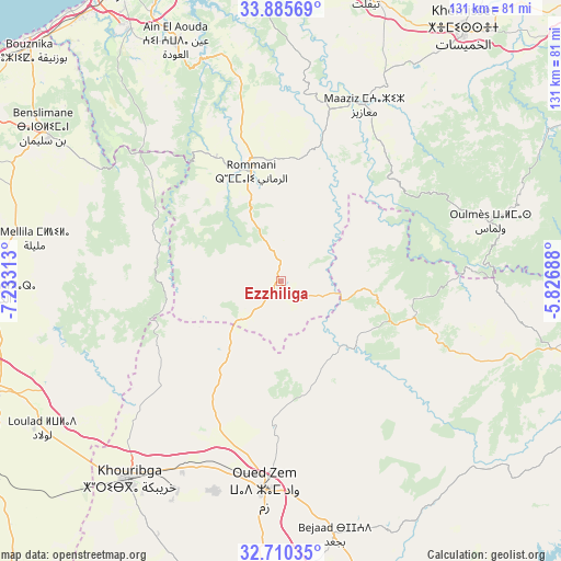
Ezzhiliga GPS coordinates[2]
33° 18' 0" North, 6° 31' 48" West
| Map corner | latitude | longitude |
|---|---|---|
| Upper-left | 33.88569°, | -7.23313° |
| Center: | 33.3°, | -6.53° |
| Lower-right: | 32.71035°, | -5.82688° |
| Map W x H: | 130.7×130.7 km | = 81.2×81.2mi |
| max Lat: | 35.84906° ⇑46.5% North |
| Ezzhiliga: | 33.3° |
| min Lat: | ⇓53.5% South 22.6558° |
| min Long | Ezzhiliga | max Long |
| -15.60719° | -6.53° | -1.22855° |
| W 42.2%⇐ | ⇒57.8% E |
Elevation
Elevation of Ezzhiliga is 718 m = 2356 ft, and this is 101.2 m = 332 ft above average elevation for this country.
| Max E: |
2637 m = 8652 ft | 39.1% |
| Ezzhiliga | 718 m 2356 ft | |
| Avg. | 616.8 m = 2024 ft | |
Min E: |
1 m = 3 ft | 60.9% |
See also: Morocco elevation on elevation.city.
Geographical zone
Ezzhiliga is located in North temperate zone (between Tropic of Cancer and the Arctic Circle). Distance of this Northern Tropic circle is 1096.7 km =681.5 mi to South.| Distance of | km | miles | from Ezzhiliga |
|---|---|---|---|
| North Pole | 6304.4 | 3917.4 | to North |
| Arctic Circle | 3698.6 | 2298.2 | to North |
| Tropic Cancer | 1096.7 | 681.5 | to South |
| Equator | 3702.6 | 2300.7 | to South |


Nearby cities:
15 places around Ezzhiliga: (largest is in red/bold)
• Aguelmous
65.4 km =40.6 mi,  103°
103°
• Boujniba
49.9 km =31 mi,  207°
207°
• Bouznika
79.8 km =49.6 mi,  313°
313°
• Kasba Tadla
81.8 km =50.8 mi,  162°
162°
• Khemisset
72.4 km =45 mi,  36°
36°
• Khouribga
58.3 km =36.2 mi,  216°
216°
• Mellila
57.4 km =35.7 mi,  278°
278°
• Oued Zem
48.8 km =30.3 mi,  184°
184°
• Oulmes
51 km =31.7 mi,  74°
74°
• Riah
80.3 km =49.9 mi,  258°
258°
• Sidi Amar
75.7 km =47 mi,  120°
120°
• Sidi Lamine
62.4 km =38.8 mi,  134°
134°
• Skhirate
77.1 km =47.9 mi,  322°
322°
• Temara
78.1 km =48.5 mi,  333°
333°
• Tiflet
69.3 km =43.1 mi,  17°
17°
Sources, notices
• [Note1] Compared only with cities in Morocco existing in our database
• [Src1] Map data: © OpenStreetMap contributors (CC-BY-SA)
• [Src2] Other city data from geonames.org with taken over terms of usage.
• [Src3] Geographical zone / Annual Mean Temperature by Robert A. Rohde @ Wikipedia
