Imzouren geodata
Imzouren (Tanger-Tetouan-Al Hoceima) is a seat of a third-order administrative division; located in Morocco in Africa/Casablanca (GMT+1) time zone. With population of 40,000 people, there are 58 cities with bigger population in this country. Compared to other cities in Morocco, 92.2% of cities are located further ↓South; 89.1% of cities are located further ←West and 82.2% of cities have higher elevation than Imzouren. Note1
Administrative division(s):
- Level 1: Tanger-Tetouan-Al Hoceima
- Level 2: Al-Hoceima
- Level 3: Imzouren


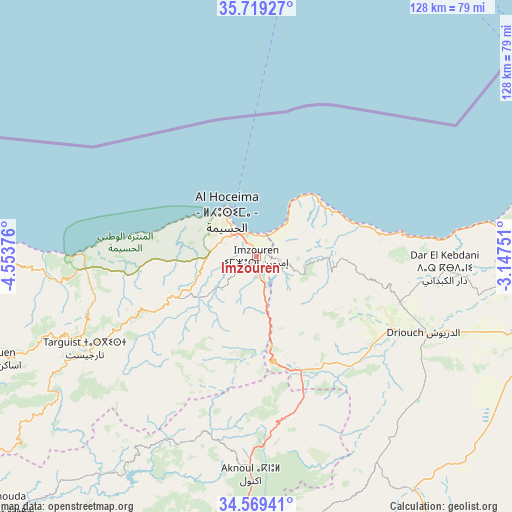
Imzouren GPS coordinates[2]
35° 8' 46.932" North, 3° 51' 2.268" West
| Map corner | latitude | longitude |
|---|---|---|
| Upper-left | 35.71927°, | -4.55376° |
| Center: | 35.14637°, | -3.85063° |
| Lower-right: | 34.56941°, | -3.14751° |
| Map W x H: | 127.9×127.9 km | = 79.5×79.5mi |
| max Lat: | 35.84906° ⇑7.8% North |
| Imzouren: | 35.14637° |
| min Lat: | ⇓92.2% South 22.6558° |
| min Long | Imzouren | max Long |
| -15.60719° | -3.85063° | -1.22855° |
| W 89.1%⇐ | ⇒10.9% E |
Elevation
Elevation of Imzouren is 77 m = 253 ft, and this is 539.8 m = 1771 ft below average elevation for this country.
| Max E: |
2637 m = 8652 ft | 82.2% |
| Avg. | 616.8 m = 2024 ft | |
| Imzouren | 77 m = 253 ft | |
Min E: |
1 m = 3 ft | 17.8% |
See also: Imzouren elevation on elevation.city.
Geographical zone
Imzouren is located in North temperate zone (between Tropic of Cancer and the Arctic Circle). Distance of this Northern Tropic circle is 1302 km =809 mi to South.| Distance of | km | miles | from Imzouren |
|---|---|---|---|
| North Pole | 6099.2 | 3789.9 | to North |
| Arctic Circle | 3493.3 | 2170.6 | to North |
| Tropic Cancer | 1302 | 809 | to South |
| Equator | 3907.9 | 2428.3 | to South |


Nearby cities:
15 places around Imzouren: (largest is in red/bold)
• Ajdir
46.2 km =28.7 mi,  194°
194°
• Aknoul
54.8 km =34.1 mi,  181°
181°
• Al Aaroui
78 km =48.5 mi,  101°
101°
• Al Hoceïma
14.1 km =8.8 mi,  326°
326°
• Bni Bouayach
4.7 km =2.9 mi,  168°
168°
• Boudinar
20.7 km =12.9 mi,  87°
87°
• Midar
36.9 km =22.9 mi,  128°
128°
• Nador
83.4 km =51.8 mi, 88°
• Rouadi
26 km =16.2 mi,  268°
268°
• Selouane
83 km =51.6 mi, 95°
• Senada
34.2 km =21.3 mi,  256°
256°
• Taouima
83.9 km =52.1 mi, 91°
• Targuist
48.5 km =30.1 mi,  241°
241°
• Tirhanimîne
13.7 km =8.5 mi,  316°
316°
• Tiztoutine
66.4 km =41.3 mi,  107°
107°
Sources, notices
• [Note1] Compared only with cities in Morocco existing in our database
• [Src1] Map data: © OpenStreetMap contributors (CC-BY-SA)
• [Src2] Other city data from geonames.org with taken over terms of usage.
• [Src3] Geographical zone / Annual Mean Temperature by Robert A. Rohde @ Wikipedia
