Senada geodata
Senada (Tanger-Tetouan-Al Hoceima) is a seat of a third-order administrative division; located in Morocco in Africa/Casablanca (GMT+1) time zone. In our database, there are 108 cities with bigger population. Compared to other cities in Morocco, 89.5% of cities are located further ↓South; 84.1% of cities are located further ←West and 65.1% of cities have higher elevation than Senada. Note1


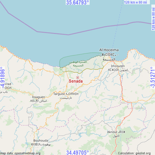
Senada GPS coordinates[2]
35° 4' 28.272" North, 4° 12' 56.988" West
| Map corner | latitude | longitude |
|---|---|---|
| Upper-left | 35.64793°, | -4.91896° |
| Center: | 35.07452°, | -4.21583° |
| Lower-right: | 34.49705°, | -3.51271° |
| Map W x H: | 128×128 km | = 79.5×79.5mi |
| max Lat: | 35.84906° ⇑10.5% North |
| Senada: | 35.07452° |
| min Lat: | ⇓89.5% South 22.6558° |
| min Long | Senada | max Long |
| -15.60719° | -4.21583° | -1.22855° |
| W 84.1%⇐ | ⇒15.9% E |
Elevation
Elevation of Senada is 290 m = 951 ft, and this is 326.8 m = 1072 ft below average elevation for this country.
| Max E: |
2637 m = 8652 ft | 65.1% |
| Avg. | 616.8 m = 2024 ft | |
| Senada | 290 m = 951 ft | |
Min E: |
1 m = 3 ft | 34.9% |
See also: Morocco elevation on elevation.city.
Geographical zone
Senada is located in North temperate zone (between Tropic of Cancer and the Arctic Circle). Distance of this Northern Tropic circle is 1294 km =804.1 mi to South.| Distance of | km | miles | from Senada |
|---|---|---|---|
| North Pole | 6107.1 | 3794.8 | to North |
| Arctic Circle | 3501.3 | 2175.6 | to North |
| Tropic Cancer | 1294 | 804.1 | to South |
| Equator | 3899.9 | 2423.3 | to South |


Nearby cities:
15 places around Senada: (largest is in red/bold)
• Ajdir
42.8 km =26.6 mi,  149°
149°
• Aknoul
56.6 km =35.2 mi, 145°
• Al Hoceïma
32.1 km =19.9 mi,  52°
52°
• Bni Bouayach
34.3 km =21.3 mi,  84°
84°
• Boudinar
54.6 km =33.9 mi, 80°
• Galaz
79.7 km =49.5 mi,  222°
222°
• Imzouren
34.2 km =21.3 mi, 76°
• Midar
63.9 km =39.7 mi,  103°
103°
• Ratba
73.8 km =45.9 mi,  243°
243°
• Rouadi
10.4 km =6.5 mi,  44°
44°
• Tamorot
53.6 km =33.3 mi,  253°
253°
• Taounate
71.3 km =44.3 mi,  212°
212°
• Targuist
17.9 km =11.1 mi, 211°
• Timezgana
72.3 km =44.9 mi, 220°
• Tirhanimîne
29.8 km =18.5 mi, 52°
Sources, notices
• [Note1] Compared only with cities in Morocco existing in our database
• [Src1] Map data: © OpenStreetMap contributors (CC-BY-SA)
• [Src2] Other city data from geonames.org with taken over terms of usage.
• [Src3] Geographical zone / Annual Mean Temperature by Robert A. Rohde @ Wikipedia
