Tirhanimîne geodata
Tirhanimîne (Tanger-Tetouan-Al Hoceima) is a populated place; located in Morocco in Africa/Casablanca (GMT+1) time zone. With population of 55,827 people, there are 46 cities with bigger population in this country. Compared to other cities in Morocco, 94.2% of cities are located further ↓South; 88% of cities are located further ←West and 70.9% of cities have higher elevation than Tirhanimîne. Note1


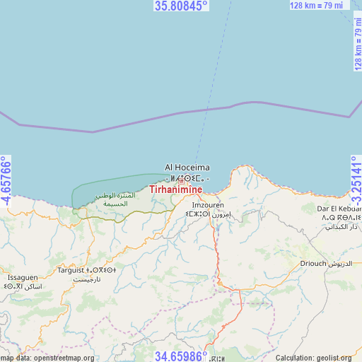
Tirhanimîne GPS coordinates[2]
35° 14' 10.284" North, 3° 57' 16.308" West
| Map corner | latitude | longitude |
|---|---|---|
| Upper-left | 35.80845°, | -4.65766° |
| Center: | 35.23619°, | -3.95453° |
| Lower-right: | 34.65986°, | -3.25141° |
| Map W x H: | 127.7×127.7 km | = 79.3×79.3mi |
| max Lat: | 35.84906° ⇑5.8% North |
| Tirhanimîne: | 35.23619° |
| min Lat: | ⇓94.2% South 22.6558° |
| min Long | Tirhanimîne | max Long |
| -15.60719° | -3.95453° | -1.22855° |
| W 88%⇐ | ⇒12% E |
Elevation
Elevation of Tirhanimîne is 209 m = 686 ft, and this is 407.8 m = 1338 ft below average elevation for this country.
| Max E: |
2637 m = 8652 ft | 70.9% |
| Avg. | 616.8 m = 2024 ft | |
| Tirhanimîne | 209 m = 686 ft | |
Min E: |
1 m = 3 ft | 29.1% |
See also: Tirhanimîne elevation on elevation.city.
Geographical zone
Tirhanimîne is located in North temperate zone (between Tropic of Cancer and the Arctic Circle). Distance of this Northern Tropic circle is 1312 km =815.2 mi to South.| Distance of | km | miles | from Tirhanimîne |
|---|---|---|---|
| North Pole | 6089.2 | 3783.7 | to North |
| Arctic Circle | 3483.3 | 2164.4 | to North |
| Tropic Cancer | 1312 | 815.2 | to South |
| Equator | 3917.9 | 2434.5 | to South |


Nearby cities:
15 places around Tirhanimîne: (largest is in red/bold)
• Ajdir
54.8 km =34.1 mi,  182°
182°
• Aknoul
65.2 km =40.5 mi,  173°
173°
• Al Aaroui
89.5 km =55.6 mi,  106°
106°
• Al Hoceïma
2.3 km =1.4 mi,  42°
42°
• Bni Bouayach
17.9 km =11.1 mi,  144°
144°
• Boudinar
31.4 km =19.5 mi, 106°
• Imzouren
13.7 km =8.5 mi, 136°
• Midar
50.5 km =31.4 mi,  130°
130°
• Nador
93.1 km =57.8 mi,  94°
94°
• Rouadi
19.6 km =12.2 mi,  237°
237°
• Selouane
93.8 km =58.3 mi,  101°
101°
• Senada
29.8 km =18.5 mi,  232°
232°
• Tamorot
82.1 km =51 mi,  246°
246°
• Targuist
46.9 km =29.1 mi,  224°
224°
• Tiztoutine
78.6 km =48.8 mi, 111°
Sources, notices
• [Note1] Compared only with cities in Morocco existing in our database
• [Src1] Map data: © OpenStreetMap contributors (CC-BY-SA)
• [Src2] Other city data from geonames.org with taken over terms of usage.
• [Src3] Geographical zone / Annual Mean Temperature by Robert A. Rohde @ Wikipedia
