Ajdir geodata
Ajdir (Fès-Meknès) is a seat of a third-order administrative division; located in Morocco in Africa/Casablanca (GMT+1) time zone. In our database, there are 108 cities with bigger population. Compared to other cities in Morocco, 80.2% of cities are located further ↓South; 87.6% of cities are located further ←West and 80.2% of cities have lower elevation than Ajdir. Note1


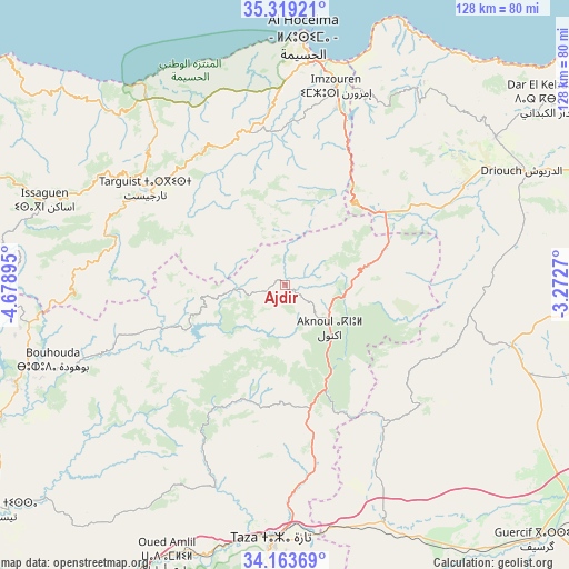
Ajdir GPS coordinates[2]
34° 44' 36.492" North, 3° 58' 32.952" West
| Map corner | latitude | longitude |
|---|---|---|
| Upper-left | 35.31921°, | -4.67895° |
| Center: | 34.74347°, | -3.97582° |
| Lower-right: | 34.16369°, | -3.2727° |
| Map W x H: | 128.5×128.5 km | = 79.8×79.8mi |
| max Lat: | 35.84906° ⇑19.8% North |
| Ajdir: | 34.74347° |
| min Lat: | ⇓80.2% South 22.6558° |
| min Long | Ajdir | max Long |
| -15.60719° | -3.97582° | -1.22855° |
| W 87.6%⇐ | ⇒12.4% E |
Elevation
Elevation of Ajdir is 1060 m = 3478 ft, and this is 443.2 m = 1454 ft above average elevation for this country.
| Max E: |
2637 m = 8652 ft | 19.8% |
| Ajdir | 1060 m 3478 ft | |
| Avg. | 616.8 m = 2024 ft | |
Min E: |
1 m = 3 ft | 80.2% |
See also: Morocco elevation on elevation.city.
Geographical zone
Ajdir is located in North temperate zone (between Tropic of Cancer and the Arctic Circle). Distance of this Northern Tropic circle is 1257.2 km =781.2 mi to South.| Distance of | km | miles | from Ajdir |
|---|---|---|---|
| North Pole | 6144 | 3817.7 | to North |
| Arctic Circle | 3538.1 | 2198.5 | to North |
| Tropic Cancer | 1257.2 | 781.2 | to South |
| Equator | 3863.1 | 2400.4 | to South |


Nearby cities:
15 places around Ajdir: (largest is in red/bold)
• Aknoul
14.1 km =8.8 mi,  135°
135°
• Al Hoceïma
56.6 km =35.2 mi,  3°
3°
• Bni Bouayach
42.1 km =26.2 mi,  17°
17°
• Boudinar
56 km =34.8 mi,  34°
34°
• Imzouren
46.2 km =28.7 mi,  14°
14°
• Midar
45.9 km =28.5 mi,  61°
61°
• Oued Amlil
66.6 km =41.4 mi,  204°
204°
• Oulad Daoud
75.7 km =47 mi,  240°
240°
• Rouadi
46.6 km =29 mi,  341°
341°
• Senada
42.8 km =26.6 mi,  329°
329°
• Taounate
65 km =40.4 mi,  249°
249°
• Targuist
38 km =23.6 mi,  304°
304°
• Taza
59.4 km =36.9 mi,  183°
183°
• Timezgana
71.3 km =44.3 mi,  255°
255°
• Tirhanimîne
54.8 km =34.1 mi, 2°
Sources, notices
• [Note1] Compared only with cities in Morocco existing in our database
• [Src1] Map data: © OpenStreetMap contributors (CC-BY-SA)
• [Src2] Other city data from geonames.org with taken over terms of usage.
• [Src3] Geographical zone / Annual Mean Temperature by Robert A. Rohde @ Wikipedia
