Imlili geodata
Imlili (Dakhla-Oued Ed-Dahab) is a populated place; located in Morocco in Africa/Casablanca (GMT+1) time zone. With population of 2,269 people, there are 101 cities with bigger population in this country. Compared to other cities in Morocco, 100% of cities are located further ↑North; 100% of cities are located further →East and 69.8% of cities have higher elevation than Imlili. Note1


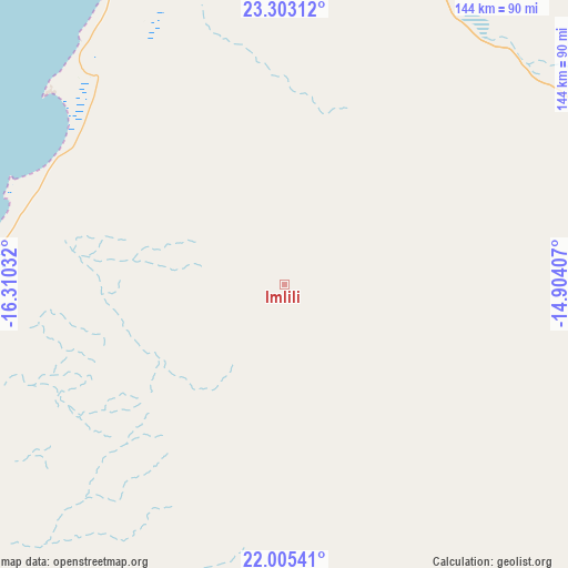
Imlili GPS coordinates[2]
22° 39' 20.88" North, 15° 36' 25.884" West
| Map corner | latitude | longitude |
|---|---|---|
| Upper-left | 23.30312°, | -16.31032° |
| Center: | 22.6558°, | -15.60719° |
| Lower-right: | 22.00541°, | -14.90407° |
| Map W x H: | 144.3×144.3 km | = 89.7×89.7mi |
| max Lat: | 35.84906° ⇑100% North |
| Imlili: | 22.6558° |
| min Lat: | ⇓0% South 22.6558° |
| min Long | Imlili | max Long |
| -15.60719° | -15.60719° | -1.22855° |
| W 0%⇐ | ⇒100% E |
Elevation
Elevation of Imlili is 230 m = 755 ft, and this is 386.8 m = 1269 ft below average elevation for this country.
| Max E: |
2637 m = 8652 ft | 69.8% |
| Avg. | 616.8 m = 2024 ft | |
| Imlili | 230 m = 755 ft | |
Min E: |
1 m = 3 ft | 30.2% |
See also: Morocco elevation on elevation.city.
Geographical zone
Imlili is located in North Torrid zone (between Equator and Tropic of Cancer). Distance of this Northern Tropic circle is 86.8 km =53.9 mi to North.| Distance of | km | miles | from Imlili |
|---|---|---|---|
| North Pole | 7488 | 4652.8 | to North |
| Arctic Circle | 4882.1 | 3033.6 | to North |
| Tropic Cancer | 86.8 | 53.9 | to North |
| Equator | 2519.1 | 1565.3 | to South |


Nearby cities:
15 places around Imlili: (largest is in red/bold)
• Agadir
1049.6 km =652.2 mi,  34°
34°
• Akhfennir
702.2 km =436.3 mi, 30°
• Guelmim
896.4 km =557 mi,  38°
38°
• Gueltat Zemmour
429.7 km =267 mi,  49°
49°
• Inezgane
1047.3 km =650.8 mi, 35°
• Ouijjane
983.3 km =611 mi, 37°
• Reggada
969.4 km =602.4 mi, 37°
• Sidi Ifni
923.7 km =574 mi, 35°
• Smara
603.3 km =374.9 mi, 41°
• Tafraout
1026.9 km =638.1 mi, 40°
• Tan-Tan
785.6 km =488.1 mi, 35°
• Tanalt
1019 km =633.2 mi, 39°
• Tarfaya
646.3 km =401.6 mi,  24°
24°
• Tarsouat
1011.7 km =628.6 mi, 40°
• Tiznit
977.7 km =607.5 mi, 36°
Sources, notices
• [Note1] Compared only with cities in Morocco existing in our database
• [Src1] Map data: © OpenStreetMap contributors (CC-BY-SA)
• [Src2] Other city data from geonames.org with taken over terms of usage.
• [Src3] Geographical zone / Annual Mean Temperature by Robert A. Rohde @ Wikipedia
