Taraclia geodata
Taraclia is a seat of a first-order administrative division; located in Moldova in Europe/Chisinau (GMT+3) time zone. With population of 13,512 people, there are 27 cities with bigger population in this country. Compared to other cities in Moldova, 97.3% of cities are located further ↑North; 50.7% of cities are located further ←West and 60.3% of cities have higher elevation than Taraclia. Note1


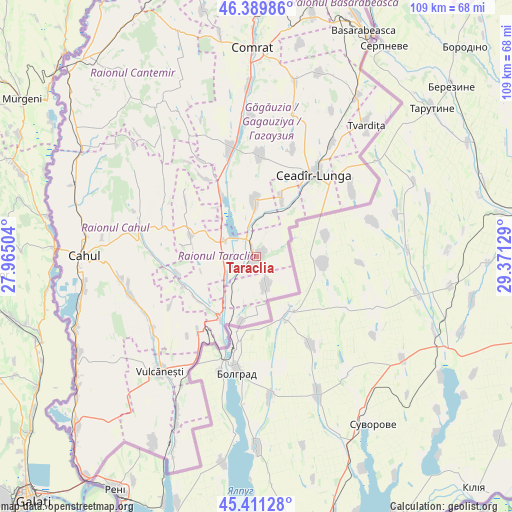
Taraclia GPS coordinates[2]
45° 54' 9.828" North, 28° 40' 5.376" East
| Map corner | latitude | longitude |
|---|---|---|
| Upper-left | 46.38986°, | 27.96504° |
| Center: | 45.90273°, | 28.66816° |
| Lower-right: | 45.41128°, | 29.37129° |
| Map W x H: | 108.8×108.8 km | = 67.6×67.6mi |
| max Lat: | 48.43285° ⇑97.3% North |
| Taraclia: | 45.90273° |
| min Lat: | ⇓2.7% South 45.48167° |
| min Long | Taraclia | max Long |
| 27.07787° | 28.66816° | 29.9617° |
| W 50.7%⇐ | ⇒49.3% E |
Elevation
Elevation of Taraclia is 65 m = 213 ft, and this is 27.8 m = 91 ft below average elevation for this country.
| Max E: |
241 m = 791 ft | 60.3% |
| Avg. | 92.8 m = 304 ft | |
| Taraclia | 65 m = 213 ft | |
Min E: |
11 m = 36 ft | 39.7% |
See also: Moldova elevation on elevation.city.
Geographical zone
Taraclia is located in North temperate zone (between Tropic of Cancer and the Arctic Circle). Distance of this North polar circle is 2297.3 km =1427.5 mi to North.| Distance of | km | miles | from Taraclia |
|---|---|---|---|
| North Pole | 4903.2 | 3046.7 | to North |
| Arctic Circle | 2297.3 | 1427.5 | to North |
| Tropic Cancer | 2498 | 1552.2 | to South |
| Equator | 5103.9 | 3171.4 | to South |


Nearby cities:
15 places around Taraclia: (largest is in red/bold)
• Basarabeasca
52.9 km =32.9 mi,  25°
25°
• Bugeac
51.5 km =32 mi,  359°
359°
• Cahul
36.3 km =22.6 mi,  270°
270°
• Cantemir
55 km =34.2 mi,  319°
319°
• Ceadîr-Lunga
21.7 km =13.5 mi,  35°
35°
• Cimişlia
69.8 km =43.4 mi,  6°
6°
• Comrat
43.6 km =27.1 mi, 358°
• Căuşeni
99.6 km =61.9 mi, 34°
• Dancu
101.5 km =63.1 mi,  339°
339°
• Giurgiuleşti
59.4 km =36.9 mi,  217°
217°
• Iargara
61 km =37.9 mi, 342°
• Leova
71.9 km =44.7 mi,  333°
333°
• Tvardița
35.6 km =22.1 mi, 40°
• Vişniovca
50.7 km =31.5 mi, 340°
• Vulcăneşti
31.6 km =19.6 mi, 219°
Sources, notices
• [Note1] Compared only with cities in Moldova existing in our database
• [Src1] Map data: © OpenStreetMap contributors (CC-BY-SA)
• [Src2] Other city data from geonames.org with taken over terms of usage.
• [Src3] Geographical zone / Annual Mean Temperature by Robert A. Rohde @ Wikipedia
