Rongelap geodata
Rongelap (Rongelap Atoll) is a seat of a first-order administrative division; located in Marshall Islands in Pacific/Majuro (GMT+12) time zone. With population of 19 people, there are 19 cities with bigger population in this country. Compared to other cities in Marshall Islands, 91.7% of cities are located further ↓South; 83.3% of cities are located further →East and 70.8% of cities have lower elevation than Rongelap. Note1


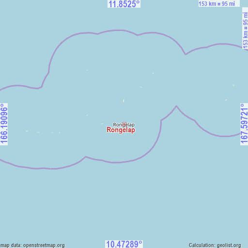
Rongelap GPS coordinates[2]
11° 9' 48.636" North, 166° 53' 38.688" East
| Map corner | latitude | longitude |
|---|---|---|
| Upper-left | 11.8525°, | 166.19096° |
| Center: | 11.16351°, | 166.89408° |
| Lower-right: | 10.47289°, | 167.59721° |
| Map W x H: | 153.4×153.4 km | = 95.3×95.3mi |
| max Lat: | 11.34735° ⇑8.3% North |
| Rongelap: | 11.16351° |
| min Lat: | ⇓91.7% South 4.58199° |
| min Long | Rongelap | max Long |
| 162.33733° | 166.89408° | 171.73502° |
| W 16.7%⇐ | ⇒83.3% E |
Elevation
Elevation of Rongelap is 11 m = 36 ft, and this is 1.3 m = 4 ft above average elevation for this country.
| Max E: |
16 m = 52 ft | 29.2% |
| Rongelap | 11 m 36 ft | |
| Avg. | 9.7 m = 32 ft | |
Min E: |
5 m = 16 ft | 70.8% |
See also: Marshall Islands elevation on elevation.city.
Geographical zone
Rongelap is located in North Torrid zone (between Equator and Tropic of Cancer). Distance of Equator is 1241.3 km =771.3 mi to South.| Distance of | km | miles | from Rongelap |
|---|---|---|---|
| North Pole | 8765.8 | 5446.8 | to North |
| Arctic Circle | 6159.9 | 3827.6 | to North |
| Tropic Cancer | 1364.7 | 848 | to North |
| Equator | 1241.3 | 771.3 | to South |


Nearby cities:
11 places around Rongelap: (largest is in red/bold)
• Ailuk
353.1 km =219.4 mi,  107°
107°
• Ebaye
281.3 km =174.8 mi,  160°
160°
• Jabat
442.9 km =275.2 mi,  148°
148°
• Lae
258.6 km =160.7 mi,  195°
195°
• Lib
321.4 km =199.7 mi,  170°
170°
• Likiep
303.2 km =188.4 mi,  119°
119°
• Loen
405.8 km =252.2 mi, 158°
• Ujae
277.2 km =172.2 mi,  206°
206°
• Utrik
322.2 km =200.2 mi,  88°
88°
• Wotho
147.1 km =91.4 mi,  221°
221°
• Wotje
412.1 km =256.1 mi, 117°
Sources, notices
• [Note1] Compared only with cities in Marshall Islands existing in our database
• [Src1] Map data: © OpenStreetMap contributors (CC-BY-SA)
• [Src2] Other city data from geonames.org with taken over terms of usage.
• [Src3] Geographical zone / Annual Mean Temperature by Robert A. Rohde @ Wikipedia
