Loen geodata
Loen (Namu Atoll) is a seat of a first-order administrative division; located in Marshall Islands in Pacific/Majuro (GMT+12) time zone. In our database, there are 20 cities with bigger population. Compared to other cities in Marshall Islands, 58.3% of cities are located further ↑North; 66.7% of cities are located further →East and 79.2% of cities have lower elevation than Loen. Note1


Loen GPS coordinates[2]
7° 45' 36.252" North, 168° 13' 50.592" East
| Map corner | latitude | longitude |
|---|---|---|
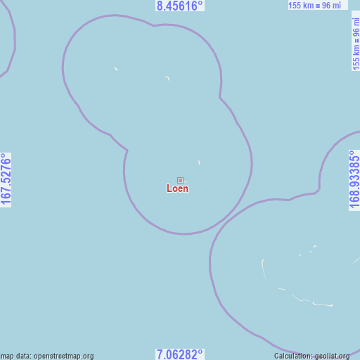
| Upper-left | 8.45616°, | 167.5276° |
| Center: | 7.76007°, | 168.23072° |
| Lower-right: | 7.06282°, | 168.93385° |
| Map W x H: | 154.9×154.9 km | = 96.3×96.3mi |
| max Lat: | 11.34735° ⇑58.3% North |
| Loen: | 7.76007° |
| min Lat: | ⇓41.7% South 4.58199° |
| min Long | Loen | max Long |
| 162.33733° | 168.23072° | 171.73502° |
| W 33.3%⇐ | ⇒66.7% E |
Elevation
Elevation of Loen is 13 m = 43 ft, and this is 3.3 m = 11 ft above average elevation for this country.
| Max E: |
16 m = 52 ft | 20.8% |
| Loen | 13 m 43 ft | |
| Avg. | 9.7 m = 32 ft | |
Min E: |
5 m = 16 ft | 79.2% |
See also: Marshall Islands elevation on elevation.city.
Geographical zone
Loen is located in North Torrid zone (between Equator and Tropic of Cancer). Distance of Equator is 862.8 km =536.1 mi to South.| Distance of | km | miles | from Loen |
|---|---|---|---|
| North Pole | 9144.2 | 5681.9 | to North |
| Arctic Circle | 6538.3 | 4062.7 | to North |
| Tropic Cancer | 1743.1 | 1083.1 | to North |
| Equator | 862.8 | 536.1 | to South |


Nearby cities:
15 places around Loen: (largest is in red/bold)
• Ailuk
334.2 km =207.7 mi,  35°
35°
• Airuk
84.3 km =52.4 mi,  129°
129°
• Aur
326.4 km =202.8 mi,  82°
82°
• Ebaye
125.1 km =77.7 mi,  334°
334°
• Jabat
82 km =51 mi,  90°
90°
• Jabor
257.2 km =159.8 mi,  142°
142°
• Kili
255 km =158.4 mi,  157°
157°
• Lae
252.1 km =156.6 mi,  300°
300°
• Lib
112.3 km =69.8 mi, 303°
• Likiep
258.5 km =160.6 mi,  27°
27°
• Majuro
355.2 km =220.7 mi,  102°
102°
• Namdrik
240.7 km =149.6 mi,  183°
183°
• Taroa
346.1 km =215.1 mi,  72°
72°
• Ujae
301 km =187 mi, 295°
• Wotje
290 km =180.2 mi,  49°
49°
Sources, notices
• [Note1] Compared only with cities in Marshall Islands existing in our database
• [Src1] Map data: © OpenStreetMap contributors (CC-BY-SA)
• [Src2] Other city data from geonames.org with taken over terms of usage.
• [Src3] Geographical zone / Annual Mean Temperature by Robert A. Rohde @ Wikipedia
