Wotje geodata
Wotje (Wotje Atoll) is a seat of a first-order administrative division; located in Marshall Islands in Pacific/Majuro (GMT+12) time zone. With population of 880 people, there are 4 cities with bigger population in this country. Compared to other cities in Marshall Islands, 70.8% of cities are located further ↓South; 70.8% of cities are located further ←West and 58.3% of cities have higher elevation than Wotje. Note1


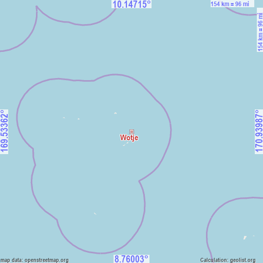
Wotje GPS coordinates[2]
9° 27' 15.444" North, 170° 14' 12.264" East
| Map corner | latitude | longitude |
|---|---|---|
| Upper-left | 10.14715°, | 169.53362° |
| Center: | 9.45429°, | 170.23674° |
| Lower-right: | 8.76003°, | 170.93987° |
| Map W x H: | 154.2×154.2 km | = 95.8×95.8mi |
| max Lat: | 11.34735° ⇑29.2% North |
| Wotje: | 9.45429° |
| min Lat: | ⇓70.8% South 4.58199° |
| min Long | Wotje | max Long |
| 162.33733° | 170.23674° | 171.73502° |
| W 70.8%⇐ | ⇒29.2% E |
Elevation
Elevation of Wotje is 9 m = 30 ft, and this is 0.7 m = 2 ft below average elevation for this country.
| Max E: |
16 m = 52 ft | 58.3% |
| Avg. | 9.7 m = 32 ft | |
| Wotje | 9 m = 30 ft | |
Min E: |
5 m = 16 ft | 41.7% |
See also: Marshall Islands elevation on elevation.city.
Geographical zone
Wotje is located in North Torrid zone (between Equator and Tropic of Cancer). Distance of Equator is 1051.2 km =653.2 mi to South.| Distance of | km | miles | from Wotje |
|---|---|---|---|
| North Pole | 8955.8 | 5564.9 | to North |
| Arctic Circle | 6350 | 3945.7 | to North |
| Tropic Cancer | 1554.7 | 966 | to North |
| Equator | 1051.2 | 653.2 | to South |


Nearby cities:
15 places around Wotje: (largest is in red/bold)
• Ailuk
89.6 km =55.7 mi,  341°
341°
• Airuk
287.9 km =178.9 mi,  212°
212°
• Arno
302.4 km =187.9 mi,  151°
151°
• Aur
177.5 km =110.3 mi,  144°
144°
• Ebaye
284.4 km =176.7 mi,  254°
254°
• Jabat
234.8 km =145.9 mi,  216°
216°
• Jabor
398.3 km =247.5 mi,  189°
189°
• Lib
338.9 km =210.6 mi, 247°
• Likiep
109.6 km =68.1 mi,  292°
292°
• Loen
290 km =180.2 mi,  229°
229°
• Majuro
291.5 km =181.1 mi, 154°
• Mejit
114.3 km =71 mi,  36°
36°
• RMI Capitol
291.5 km =181.1 mi, 154°
• Taroa
137 km =85.1 mi,  127°
127°
• Utrik
201.7 km =125.3 mi,  347°
347°
Sources, notices
• [Note1] Compared only with cities in Marshall Islands existing in our database
• [Src1] Map data: © OpenStreetMap contributors (CC-BY-SA)
• [Src2] Other city data from geonames.org with taken over terms of usage.
• [Src3] Geographical zone / Annual Mean Temperature by Robert A. Rohde @ Wikipedia
