Jabat geodata
Jabat (Jabat Island) is a seat of a first-order administrative division; located in Marshall Islands in Pacific/Kwajalein (GMT+12) time zone. With population of 112 people, there are 18 cities with bigger population in this country. Compared to other cities in Marshall Islands, 62.5% of cities are located further ↑North; 54.2% of cities are located further →East and 100% of cities have lower elevation than Jabat. Note1


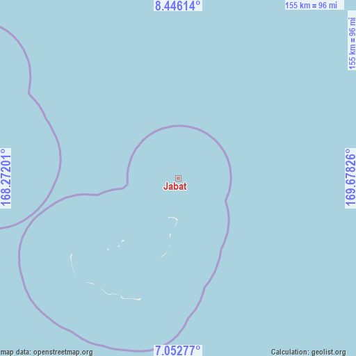
Jabat GPS coordinates[2]
7° 45' 0.108" North, 168° 58' 30.468" East
| Map corner | latitude | longitude |
|---|---|---|
| Upper-left | 8.44614°, | 168.27201° |
| Center: | 7.75003°, | 168.97513° |
| Lower-right: | 7.05277°, | 169.67826° |
| Map W x H: | 154.9×154.9 km | = 96.3×96.3mi |
| max Lat: | 11.34735° ⇑62.5% North |
| Jabat: | 7.75003° |
| min Lat: | ⇓37.5% South 4.58199° |
| min Long | Jabat | max Long |
| 162.33733° | 168.97513° | 171.73502° |
| W 45.8%⇐ | ⇒54.2% E |
Elevation
Elevation of Jabat is 16 m = 52 ft, and this is 6.3 m = 21 ft above average elevation for this country.
| Max E: |
16 m = 52 ft | 0% |
| Jabat | 16 m 52 ft | |
| Avg. | 9.7 m = 32 ft | |
Min E: |
5 m = 16 ft | 100% |
See also: Marshall Islands elevation on elevation.city.
Geographical zone
Jabat is located in North Torrid zone (between Equator and Tropic of Cancer). Distance of Equator is 861.7 km =535.4 mi to South.| Distance of | km | miles | from Jabat |
|---|---|---|---|
| North Pole | 9145.3 | 5682.6 | to North |
| Arctic Circle | 6539.5 | 4063.5 | to North |
| Tropic Cancer | 1744.2 | 1083.8 | to North |
| Equator | 861.7 | 535.4 | to South |


Nearby cities:
15 places around Jabat: (largest is in red/bold)
• Ailuk
295.9 km =183.9 mi,  21°
21°
• Airuk
55.3 km =34.4 mi,  197°
197°
• Arno
294.3 km =182.9 mi,  104°
104°
• Aur
245.6 km =152.6 mi,  79°
79°
• Ebaye
177.4 km =110.2 mi,  309°
309°
• Jabor
216.3 km =134.4 mi,  160°
160°
• Kili
234.7 km =145.8 mi,  176°
176°
• Lib
186.8 km =116.1 mi,  289°
289°
• Likiep
233.7 km =145.2 mi,  9°
9°
• Loen
82 km =51 mi,  270°
270°
• Majuro
275.2 km =171 mi,  105°
105°
• Namdrik
257.8 km =160.2 mi, 201°
• RMI Capitol
275.2 km =171 mi, 105°
• Taroa
269.7 km =167.6 mi,  66°
66°
• Wotje
234.8 km =145.9 mi,  36°
36°
Sources, notices
• [Note1] Compared only with cities in Marshall Islands existing in our database
• [Src1] Map data: © OpenStreetMap contributors (CC-BY-SA)
• [Src2] Other city data from geonames.org with taken over terms of usage.
• [Src3] Geographical zone / Annual Mean Temperature by Robert A. Rohde @ Wikipedia
