Utrik geodata
Utrik (Utrik Atoll) is a seat of a first-order administrative division; located in Marshall Islands in Pacific/Majuro (GMT+12) time zone. With population of 409 people, there are 13 cities with bigger population in this country. Compared to other cities in Marshall Islands, 95.8% of cities are located further ↓South; 62.5% of cities are located further ←West and 50% of cities have lower elevation than Utrik. Note1


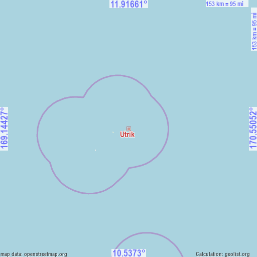
Utrik GPS coordinates[2]
11° 13' 40.008" North, 169° 50' 50.604" East
| Map corner | latitude | longitude |
|---|---|---|
| Upper-left | 11.91661°, | 169.14427° |
| Center: | 11.22778°, | 169.84739° |
| Lower-right: | 10.5373°, | 170.55052° |
| Map W x H: | 153.4×153.4 km | = 95.3×95.3mi |
| max Lat: | 11.34735° ⇑4.2% North |
| Utrik: | 11.22778° |
| min Lat: | ⇓95.8% South 4.58199° |
| min Long | Utrik | max Long |
| 162.33733° | 169.84739° | 171.73502° |
| W 62.5%⇐ | ⇒37.5% E |
Elevation
Elevation of Utrik is 10 m = 33 ft, and this is 0.3 m = 1 ft above average elevation for this country.
| Max E: |
16 m = 52 ft | 50% |
| Utrik | 10 m 33 ft | |
| Avg. | 9.7 m = 32 ft | |
Min E: |
5 m = 16 ft | 50% |
See also: Marshall Islands elevation on elevation.city.
Geographical zone
Utrik is located in North Torrid zone (between Equator and Tropic of Cancer). Distance of Equator is 1248.4 km =775.7 mi to South.| Distance of | km | miles | from Utrik |
|---|---|---|---|
| North Pole | 8758.6 | 5442.3 | to North |
| Arctic Circle | 6152.8 | 3823.2 | to North |
| Tropic Cancer | 1357.5 | 843.5 | to North |
| Equator | 1248.4 | 775.7 | to South |


Nearby cities:
12 places around Utrik: (largest is in red/bold)
• Ailuk
113 km =70.2 mi,  172°
172°
• Aur
371.6 km =230.9 mi,  157°
157°
• Ebaye
357.3 km =222 mi,  220°
220°
• Jabat
398.3 km =247.5 mi,  193°
193°
• Lib
422.3 km =262.4 mi, 219°
• Likiep
166.6 km =103.5 mi,  200°
200°
• Loen
424.4 km =263.7 mi, 204°
• Mejit
153.5 km =95.4 mi,  133°
133°
• Rongelap
322.2 km =200.2 mi,  268°
268°
• Taroa
318.6 km =198 mi,  151°
151°
• Wotho
435.5 km =270.6 mi,  254°
254°
• Wotje
201.7 km =125.3 mi, 167°
Sources, notices
• [Note1] Compared only with cities in Marshall Islands existing in our database
• [Src1] Map data: © OpenStreetMap contributors (CC-BY-SA)
• [Src2] Other city data from geonames.org with taken over terms of usage.
• [Src3] Geographical zone / Annual Mean Temperature by Robert A. Rohde @ Wikipedia
