Ailuk geodata
Ailuk (Ailuk Atoll) is a seat of a first-order administrative division; located in Marshall Islands in Pacific/Majuro (GMT+12) time zone. With population of 451 people, there are 10 cities with bigger population in this country. Compared to other cities in Marshall Islands, 83.3% of cities are located further ↓South; 66.7% of cities are located further ←West and 50% of cities have lower elevation than Ailuk. Note1


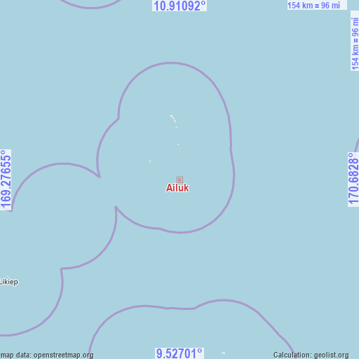
Ailuk GPS coordinates[2]
10° 13' 10.992" North, 169° 58' 46.812" East
| Map corner | latitude | longitude |
|---|---|---|
| Upper-left | 10.91092°, | 169.27655° |
| Center: | 10.21972°, | 169.97967° |
| Lower-right: | 9.52701°, | 170.6828° |
| Map W x H: | 153.9×153.9 km | = 95.6×95.6mi |
| max Lat: | 11.34735° ⇑16.7% North |
| Ailuk: | 10.21972° |
| min Lat: | ⇓83.3% South 4.58199° |
| min Long | Ailuk | max Long |
| 162.33733° | 169.97967° | 171.73502° |
| W 66.7%⇐ | ⇒33.3% E |
Elevation
Elevation of Ailuk is 10 m = 33 ft, and this is 0.3 m = 1 ft above average elevation for this country.
| Max E: |
16 m = 52 ft | 50% |
| Ailuk | 10 m 33 ft | |
| Avg. | 9.7 m = 32 ft | |
Min E: |
5 m = 16 ft | 50% |
See also: Marshall Islands elevation on elevation.city.
Geographical zone
Ailuk is located in North Torrid zone (between Equator and Tropic of Cancer). Distance of Equator is 1136.3 km =706.1 mi to South.| Distance of | km | miles | from Ailuk |
|---|---|---|---|
| North Pole | 8870.7 | 5512 | to North |
| Arctic Circle | 6264.8 | 3892.8 | to North |
| Tropic Cancer | 1469.6 | 913.2 | to North |
| Equator | 1136.3 | 706.1 | to South |


Nearby cities:
15 places around Ailuk: (largest is in red/bold)
• Airuk
351.1 km =218.2 mi,  201°
201°
• Arno
390.9 km =242.9 mi,  153°
153°
• Aur
264.6 km =164.4 mi, 150°
• Ebaye
293.6 km =182.4 mi,  236°
236°
• Jabat
295.9 km =183.9 mi, 201°
• Lib
355.8 km =221.1 mi,  233°
233°
• Likiep
85.4 km =53.1 mi, 239°
• Loen
334.2 km =207.7 mi,  215°
215°
• Majuro
380.5 km =236.4 mi,  156°
156°
• Mejit
97 km =60.3 mi,  86°
86°
• RMI Capitol
380.6 km =236.5 mi, 156°
• Rongelap
353.1 km =219.4 mi,  287°
287°
• Taroa
216.9 km =134.8 mi,  140°
140°
• Utrik
113 km =70.2 mi,  352°
352°
• Wotje
89.6 km =55.7 mi, 161°
Sources, notices
• [Note1] Compared only with cities in Marshall Islands existing in our database
• [Src1] Map data: © OpenStreetMap contributors (CC-BY-SA)
• [Src2] Other city data from geonames.org with taken over terms of usage.
• [Src3] Geographical zone / Annual Mean Temperature by Robert A. Rohde @ Wikipedia
