Kyain Seikgyi Township geodata
Kyain Seikgyi Township (Kayin) is a populated place(s); located in Myanmar in Asia/Yangon (GMT+6.5) time zone. With population of 246,065 people, there are 4 cities with bigger population in this country. Compared to other cities in Myanmar, 95.9% of cities are located further ↑North; 91.9% of cities are located further ←West and 52.7% of cities have lower elevation than Kyain Seikgyi Township. Note1
Administrative division(s):
- Level 1: Kayin
- Level 2: Kawkareik District
- Level 3: Kyain Seikgyi Township
Current local time in Kyain Seikgyi Township:
08:01 PM, WednesdayDifference from your time zone: hours


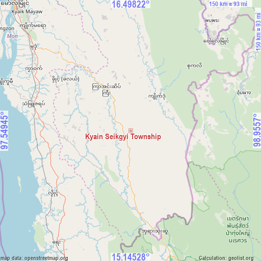
Kyain Seikgyi Township GPS coordinates[2]
15° 49' 22.368" North, 98° 15' 9.252" East
| Map corner | latitude | longitude |
|---|---|---|
| Upper-left | 16.49822°, | 97.54945° |
| Center: | 15.82288°, | 98.25257° |
| Lower-right: | 15.14528°, | 98.9557° |
| Map W x H: | 150.4×150.4 km | = 93.5×93.5mi |
| max Lat: | 25.38327° ⇑95.9% North |
| Kyain Seikgyi Township: | 15.82288° |
| min Lat: | ⇓4.1% South 9.98238° |
| min Long | Kyain Seikgyi T | max Long |
| 92.89835° | 98.25257° | 99.88083° |
| W 91.9%⇐ | ⇒8.1% E |
Elevation
Elevation of Kyain Seikgyi Township is 40 m = 131 ft, and this is 148.9 m = 489 ft below average elevation for this country.
| Max E: |
1768 m = 5801 ft | 47.3% |
| Avg. | 188.9 m = 620 ft | |
| Kyain Seikgyi Township | 40 m = 131 ft | |
Min E: |
5 m = 16 ft | 52.7% |
See also: Kyain Seikgyi Township elevation on elevation.city.
Geographical zone
Kyain Seikgyi Township is located in North Torrid zone (between Equator and Tropic of Cancer). Distance of this Northern Tropic circle is 846.6 km =526.1 mi to North.| Distance of | km | miles | from Kyain Seikgyi Township |
|---|---|---|---|
| North Pole | 8247.7 | 5124.9 | to North |
| Arctic Circle | 5641.8 | 3505.7 | to North |
| Tropic Cancer | 846.6 | 526.1 | to North |
| Equator | 1759.3 | 1093.2 | to South |


Nearby cities:
15 places around Kyain Seikgyi Township: (largest is in red/bold)
• Dawei
193.6 km =120.3 mi,  181°
181°
• Dellok
43.2 km =26.8 mi,  304°
304°
• Hpa-An
135.7 km =84.3 mi,  330°
330°
• Klonhtoug
24.1 km =15 mi,  52°
52°
• Kyaikkami
78.9 km =49 mi,  290°
290°
• Kyaikto
211.6 km =131.5 mi,  321°
321°
• Martaban
103.8 km =64.5 mi, 319°
• Mawlamyine
99.8 km =62 mi, 318°
• Mikenaungea
24 km =14.9 mi, 51°
• Mudon
74.2 km =46.1 mi,  310°
310°
• Myawadi
100.1 km =62.2 mi,  15°
15°
• Pulei
47.7 km =29.6 mi, 303°
• Tagondaing
45.9 km =28.5 mi, 306°
• Tamoowoug
43.1 km =26.8 mi, 303°
• Thaton
154 km =95.7 mi, 322°
Sources, notices
• [Note1] Compared only with cities in Myanmar existing in our database
• [Src1] Map data: © OpenStreetMap contributors (CC-BY-SA)
• [Src2] Other city data from geonames.org with taken over terms of usage.
• [Src3] Geographical zone / Annual Mean Temperature by Robert A. Rohde @ Wikipedia
