Martaban geodata
Martaban (Mon) is a populated place; located in Myanmar in Asia/Yangon (GMT+6.5) time zone. With population of 48,629 people, there are 49 cities with bigger population in this country. Compared to other cities in Myanmar, 77% of cities are located further ↑North; 78.4% of cities are located further ←West and 56.8% of cities have higher elevation than Martaban. Note1


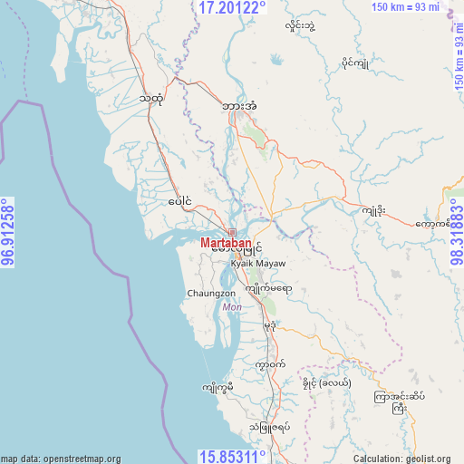
Martaban GPS coordinates[2]
16° 31' 42.024" North, 97° 36' 56.52" East
| Map corner | latitude | longitude |
|---|---|---|
| Upper-left | 17.20122°, | 96.91258° |
| Center: | 16.52834°, | 97.6157° |
| Lower-right: | 15.85311°, | 98.31883° |
| Map W x H: | 149.9×149.9 km | = 93.1×93.1mi |
| max Lat: | 25.38327° ⇑77% North |
| Martaban: | 16.52834° |
| min Lat: | ⇓23% South 9.98238° |
| min Long | Martaban | max Long |
| 92.89835° | 97.6157° | 99.88083° |
| W 78.4%⇐ | ⇒21.6% E |
Elevation
Elevation of Martaban is 27 m = 89 ft, and this is 161.9 m = 531 ft below average elevation for this country.
| Max E: |
1768 m = 5801 ft | 56.8% |
| Avg. | 188.9 m = 620 ft | |
| Martaban | 27 m = 89 ft | |
Min E: |
5 m = 16 ft | 43.2% |
See also: Martaban elevation on elevation.city.
Geographical zone
Martaban is located in North Torrid zone (between Equator and Tropic of Cancer). Distance of this Northern Tropic circle is 768.1 km =477.3 mi to North.| Distance of | km | miles | from Martaban |
|---|---|---|---|
| North Pole | 8169.3 | 5076.2 | to North |
| Arctic Circle | 5563.4 | 3456.9 | to North |
| Tropic Cancer | 768.1 | 477.3 | to North |
| Equator | 1837.8 | 1142 | to South |


Nearby cities:
15 places around Martaban: (largest is in red/bold)
• Dellok
63.1 km =39.2 mi,  149°
149°
• Hpa-An
40.2 km =25 mi,  2°
2°
• Klonhtoug
108.1 km =67.2 mi,  126°
126°
• Kyaikkami
50.5 km =31.4 mi,  186°
186°
• Kyaikto
108 km =67.1 mi,  323°
323°
• Kyain Seikgyi Township
103.8 km =64.5 mi,  139°
139°
• Mawlamyine
4.4 km =2.7 mi,  162°
162°
• Mikenaungea
107.3 km =66.7 mi, 126°
• Mudon
32.4 km =20.1 mi, 158°
• Myawadi
96.8 km =60.1 mi,  79°
79°
• Pulei
59.1 km =36.7 mi, 151°
• Tagondaing
59.9 km =37.2 mi, 148°
• Tamoowoug
63.5 km =39.5 mi, 149°
• Thaton
50.7 km =31.5 mi,  328°
328°
• Thongwa
119 km =73.9 mi,  282°
282°
Sources, notices
• [Note1] Compared only with cities in Myanmar existing in our database
• [Src1] Map data: © OpenStreetMap contributors (CC-BY-SA)
• [Src2] Other city data from geonames.org with taken over terms of usage.
• [Src3] Geographical zone / Annual Mean Temperature by Robert A. Rohde @ Wikipedia
