Mudon geodata
Mudon (Mon) is a populated place; located in Myanmar in Asia/Yangon (GMT+6.5) time zone. With population of 89,123 people, there are 29 cities with bigger population in this country. Compared to other cities in Myanmar, 85.1% of cities are located further ↑North; 82.4% of cities are located further ←West and 64.9% of cities have higher elevation than Mudon. Note1


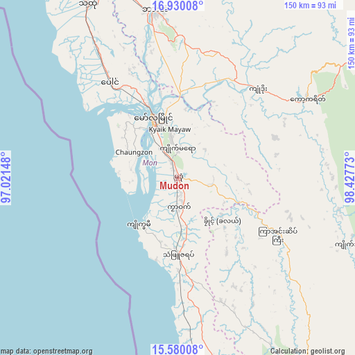
Mudon GPS coordinates[2]
16° 15' 22.464" North, 97° 43' 28.56" East
| Map corner | latitude | longitude |
|---|---|---|
| Upper-left | 16.93008°, | 97.02148° |
| Center: | 16.25624°, | 97.7246° |
| Lower-right: | 15.58008°, | 98.42773° |
| Map W x H: | 150.1×150.1 km | = 93.3×93.3mi |
| max Lat: | 25.38327° ⇑85.1% North |
| Mudon: | 16.25624° |
| min Lat: | ⇓14.9% South 9.98238° |
| min Long | Mudon | max Long |
| 92.89835° | 97.7246° | 99.88083° |
| W 82.4%⇐ | ⇒17.6% E |
Elevation
Elevation of Mudon is 22 m = 72 ft, and this is 166.9 m = 548 ft below average elevation for this country.
| Max E: |
1768 m = 5801 ft | 64.9% |
| Avg. | 188.9 m = 620 ft | |
| Mudon | 22 m = 72 ft | |
Min E: |
5 m = 16 ft | 35.1% |
See also: Mudon elevation on elevation.city.
Geographical zone
Mudon is located in North Torrid zone (between Equator and Tropic of Cancer). Distance of this Northern Tropic circle is 798.4 km =496.1 mi to North.| Distance of | km | miles | from Mudon |
|---|---|---|---|
| North Pole | 8199.5 | 5094.9 | to North |
| Arctic Circle | 5593.6 | 3475.7 | to North |
| Tropic Cancer | 798.4 | 496.1 | to North |
| Equator | 1807.5 | 1123.1 | to South |


Nearby cities:
15 places around Mudon: (largest is in red/bold)
• Dellok
31.6 km =19.6 mi,  139°
139°
• Hpa-An
71.1 km =44.2 mi,  352°
352°
• Klonhtoug
82.7 km =51.4 mi,  113°
113°
• Kyaikkami
26.3 km =16.3 mi,  220°
220°
• Kyaikto
139.5 km =86.7 mi,  327°
327°
• Kyain Seikgyi Township
74.2 km =46.1 mi,  130°
130°
• Martaban
32.4 km =20.1 mi,  338°
338°
• Mawlamyine
28 km =17.4 mi, 338°
• Mikenaungea
82 km =51 mi, 113°
• Myawadi
96.5 km =60 mi,  60°
60°
• Pulei
27.4 km =17 mi, 141°
• Tagondaing
28.6 km =17.8 mi, 137°
• Tamoowoug
31.9 km =19.8 mi, 140°
• Thaton
82.8 km =51.4 mi, 332°
• Thongwa
139.6 km =86.7 mi,  293°
293°
Sources, notices
• [Note1] Compared only with cities in Myanmar existing in our database
• [Src1] Map data: © OpenStreetMap contributors (CC-BY-SA)
• [Src2] Other city data from geonames.org with taken over terms of usage.
• [Src3] Geographical zone / Annual Mean Temperature by Robert A. Rohde @ Wikipedia
