Hpa-An geodata
Hpa-An (Kayin) is a seat of a first-order administrative division; located in Myanmar in Asia/Yangon (GMT+6.5) time zone. With population of 50,000 people, there are 47 cities with bigger population in this country. Compared to other cities in Myanmar, 63.5% of cities are located further ↑North; 81.1% of cities are located further ←West and 75.7% of cities have higher elevation than Hpa-An. Note1


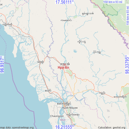
Hpa-An GPS coordinates[2]
16° 53' 22.308" North, 97° 38' 5.352" East
| Map corner | latitude | longitude |
|---|---|---|
| Upper-left | 17.56111°, | 96.9317° |
| Center: | 16.88953°, | 97.63482° |
| Lower-right: | 16.21555°, | 98.33795° |
| Map W x H: | 149.6×149.6 km | = 93×93mi |
| max Lat: | 25.38327° ⇑63.5% North |
| Hpa-An: | 16.88953° |
| min Lat: | ⇓36.5% South 9.98238° |
| min Long | Hpa-An | max Long |
| 92.89835° | 97.63482° | 99.88083° |
| W 81.1%⇐ | ⇒18.9% E |
Elevation
Elevation of Hpa-An is 18 m = 59 ft, and this is 170.9 m = 561 ft below average elevation for this country.
| Max E: |
1768 m = 5801 ft | 75.7% |
| Avg. | 188.9 m = 620 ft | |
| Hpa-An | 18 m = 59 ft | |
Min E: |
5 m = 16 ft | 24.3% |
See also: Hpa-An elevation on elevation.city.
Geographical zone
Hpa-An is located in North Torrid zone (between Equator and Tropic of Cancer). Distance of this Northern Tropic circle is 728 km =452.4 mi to North.| Distance of | km | miles | from Hpa-An |
|---|---|---|---|
| North Pole | 8129.1 | 5051.2 | to North |
| Arctic Circle | 5523.2 | 3432 | to North |
| Tropic Cancer | 728 | 452.4 | to North |
| Equator | 1877.9 | 1166.9 | to South |


Nearby cities:
15 places around Hpa-An: (largest is in red/bold)
• Bago
132.2 km =82.1 mi,  292°
292°
• Dellok
99.1 km =61.6 mi,  162°
162°
• Kayan
114.3 km =71 mi,  271°
271°
• Kyaikkami
90.7 km =56.4 mi,  184°
184°
• Kyaikto
81 km =50.3 mi,  305°
305°
• Martaban
40.2 km =25 mi, 182°
• Mawlamyine
44.4 km =27.6 mi, 180°
• Mudon
71.1 km =44.2 mi,  172°
172°
• Myawadi
95.7 km =59.5 mi,  103°
103°
• Pulei
95.7 km =59.5 mi, 163°
• Tagondaing
95.9 km =59.6 mi, 162°
• Tamoowoug
99.6 km =61.9 mi, 162°
• Thanatpin
121.2 km =75.3 mi, 291°
• Thaton
28.4 km =17.6 mi,  276°
276°
• Thongwa
119 km =73.9 mi,  263°
263°
Sources, notices
• [Note1] Compared only with cities in Myanmar existing in our database
• [Src1] Map data: © OpenStreetMap contributors (CC-BY-SA)
• [Src2] Other city data from geonames.org with taken over terms of usage.
• [Src3] Geographical zone / Annual Mean Temperature by Robert A. Rohde @ Wikipedia
